g.yo ru (left horn)
Map: Hazod
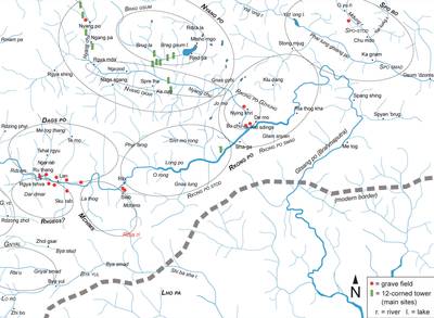
Fig. 1 The ancient territories in eastern Lho kha. (The area is locally described as belonging to the domain of the mythical 'Mon king' Mon Shing khri rgyal po, with his seat on Mt Rtsa ri)
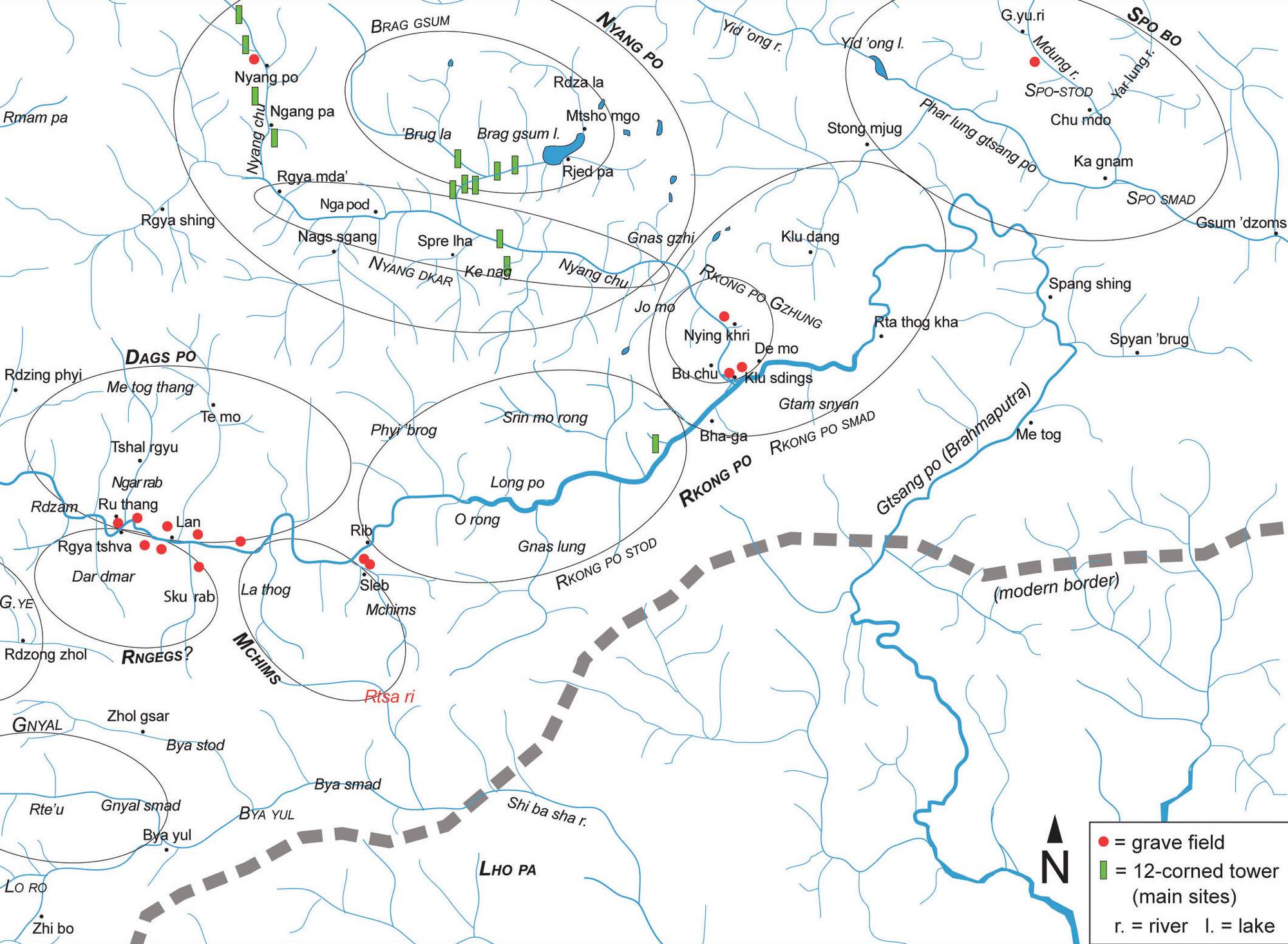
Fig. 1: The ancient territories in eastern Lho kha. (The area is locally described as belonging to the domain of the mythical 'Mon king' Mon Shing khri rgyal po, with his seat on Mt Rtsa ri) (Map: Hazod)
Satellite Photo: Google|DigitalGlobe; edited by Hazod
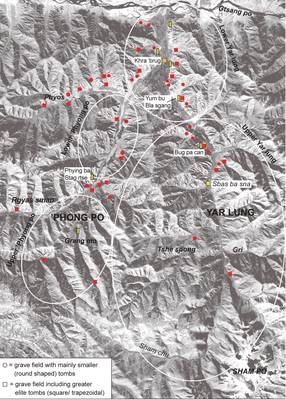
Fig. 2 The grave fields of Yar lung and 'Phyong po.
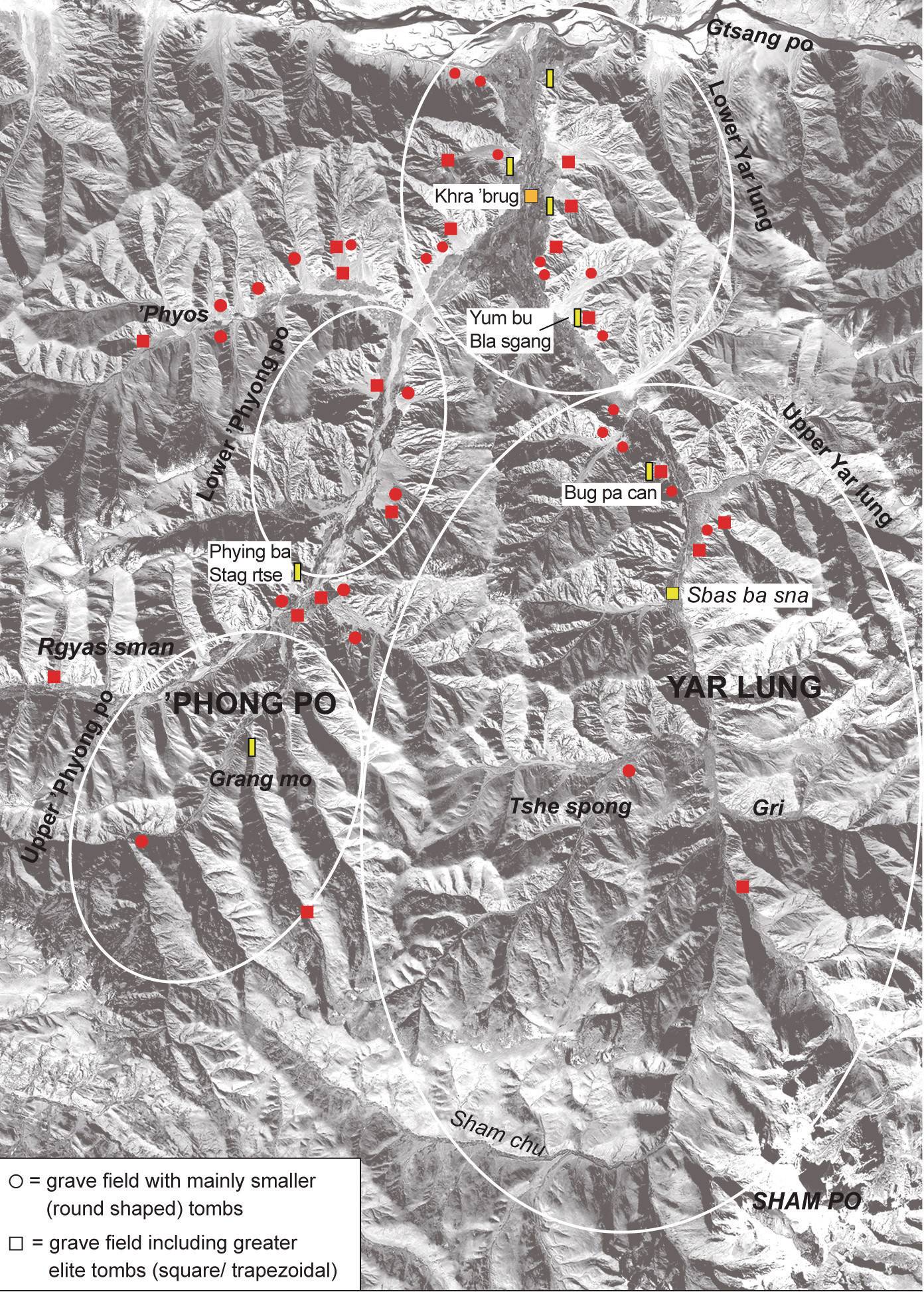
Fig. 2: The grave fields of Yar lung and 'Phyong po. (Satellite Photo: Google|DigitalGlobe; edited by Hazod)
Satellite Photo: Google|DigitalGlobe; edited by Hazod
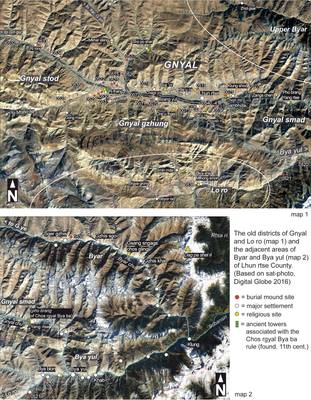
Fig. 4 The old districts of Gnyal and Lo ro and the adjacent areas of Byar and Bya yul

Fig. 4: The old districts of Gnyal and Lo ro and the adjacent areas of Byar and Bya yul (Satellite Photo: Google|DigitalGlobe; edited by Hazod)
Satellite Photo: Google|DigitalGlobe; Photos: Hazod; edited by Hazod
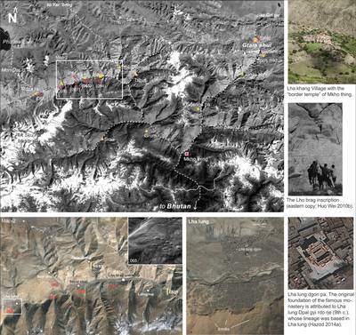
Fig. 5 The districts of Lho brag and Gtam shul. The numbers in bracket (or given in red on Map 2) indicate the grave fields in this regions. The yellow symbols on Map 2 refer to the sites of the two copies of the Lho brag inscription dedicated to the Lde’u cung family line (see 065-2). The inscriptions’ positons on the map are based on the details given in Huo Wei 2010b, which also cites local accounts regarding the situation of two identical inscriptions in this area. One of these storys says that the inscriptions originally marked the border of the land, which the Lde’u cung was granted by the emperor.
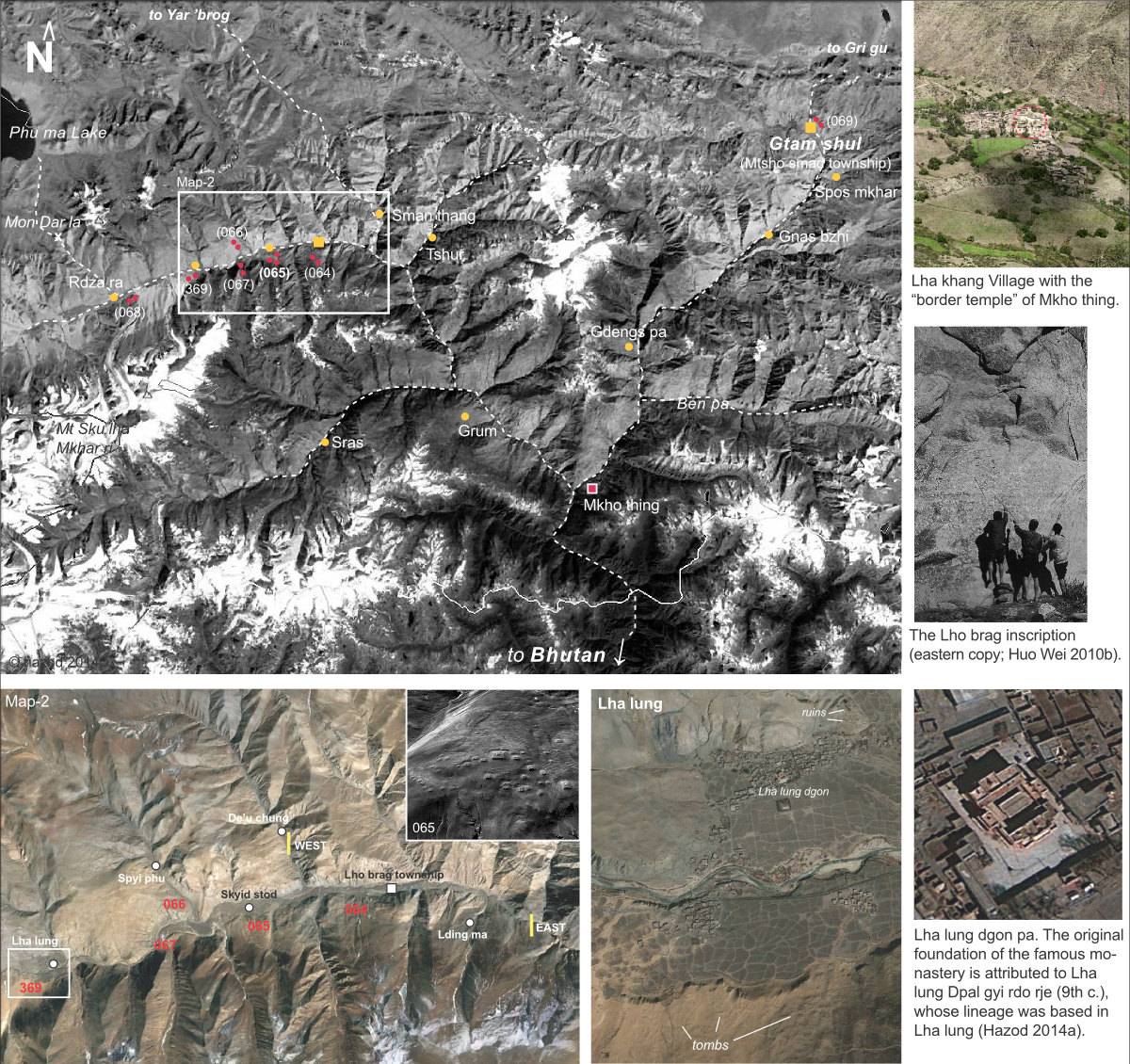
Fig. 5: The districts of Lho brag and Gtam shul. The numbers in bracket (or given in red on Map 2) indicate the grave fields in this regions. The yellow symbols on Map 2 refer to the sites of the two copies of the Lho brag inscription dedicated to the Lde’u cung family line (see 065-2). The inscriptions’ positons on the map are based on the details given in Huo Wei 2010b, which also cites local accounts regarding the situation of two identical inscriptions in this area. One of these storys says that the inscriptions originally marked the border of the land, which the Lde’u cung was granted by the emperor. (Satellite Photo: Google|DigitalGlobe; Photos: Hazod; edited by Hazod)
Satellite Photo: Google|Maxar Technologies 2020 (image data 12/2009); edited by Hazod 2021
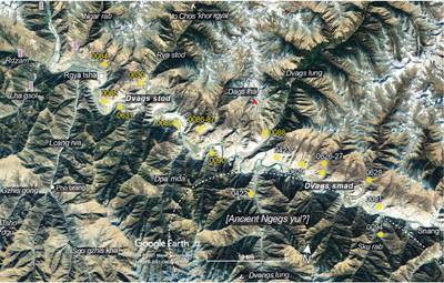
Fig. 6 The area of ancient Dags po. (Note: the burial mound sites with yellow numbers refer to grave fields of modern Rgya tsha County, numbers in blue belong are sites of Snang County; the purple symbols indicate the sites of the four “Bya khyung ’bab sa towers” of Western Dvags po.
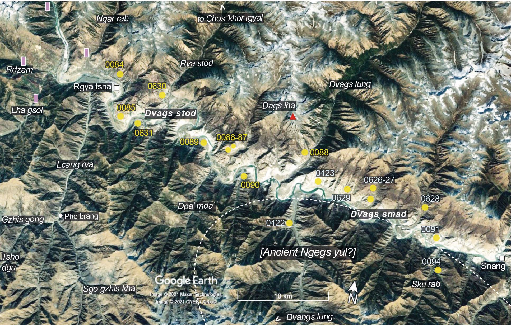
Fig. 6: The area of ancient Dags po. (Note: the burial mound sites with yellow numbers refer to grave fields of modern Rgya tsha County, numbers in blue belong are sites of Snang County; the purple symbols indicate the sites of the four “Bya khyung ’bab sa towers” of Western Dvags po. (Satellite Photo: Google|Maxar Technologies 2020 (image data 12/2009); edited by Hazod 2021)
Sat-photo: Google|DigitalGlobe (02/2009), edited by Hazod 2017
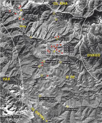
Fig. 7 The burial mounds in the ancient territory of G.ye.
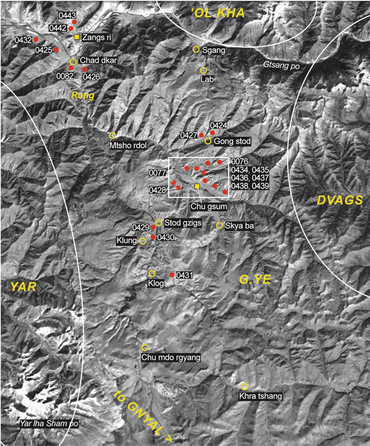
Fig. 7: The burial mounds in the ancient territory of G.ye. (Sat-photo: Google|DigitalGlobe (02/2009), edited by Hazod 2017)
Satellite Photo: Google|DigitalGlobe (10/09/2009), edited by Hazod 2017
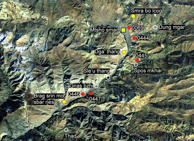
Fig. 8 The central area of the Gtsam shul district (Mtsho smad County) and its burial mound sites (red symbol)
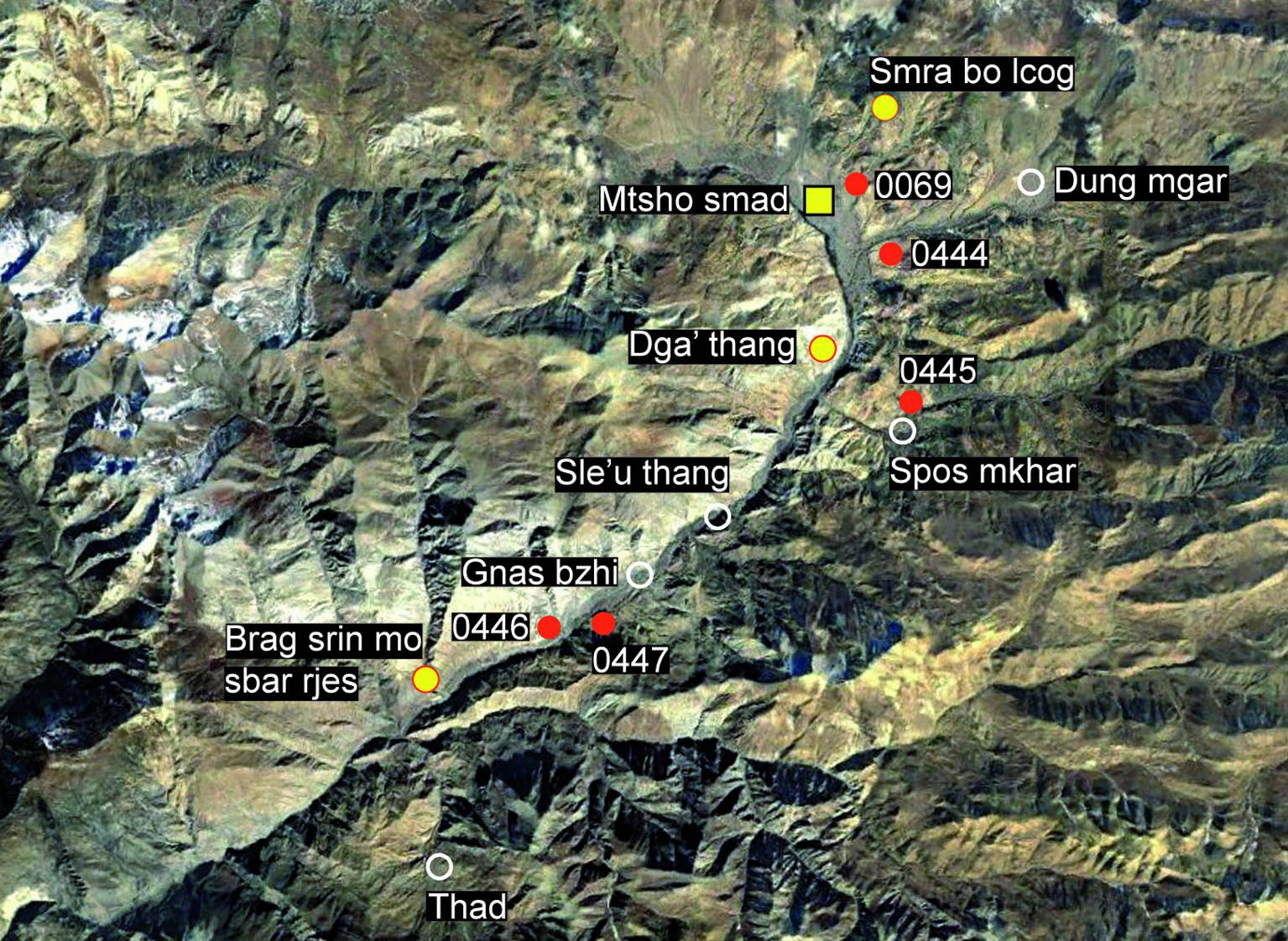
Fig. 8: The central area of the Gtsam shul district (Mtsho smad County) and its burial mound sites (red symbol) (Satellite Photo: Google|DigitalGlobe (10/09/2009), edited by Hazod 2017)

Satellite Photo: Google|DigitalGlobe, edited by Hazod 2017
Fig. 9 The burial mound sites of the Grva district (yellow symbol)

Fig. 9: The burial mound sites of the Grva district (yellow symbol) (Satellite Photo: Google|DigitalGlobe, edited by Hazod 2017)
Satellite Photo: Google|DigitalGlobe; Photos: Hazod; edited by Hazod
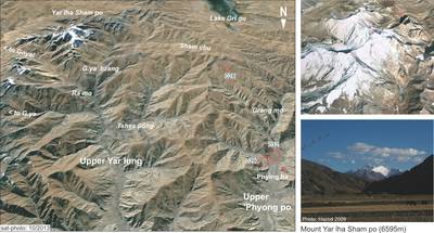
Fig. 10 The upper regions of Yar lung and ’Phyong po. (The indications of burial mound sites on this map are restricted to the place of “Tibet’s first...

Fig. 10: The upper regions of Yar lung and ’Phyong po. (The indications of burial mound sites on this map are restricted to the place of “Tibet’s first... (Satellite Photo: Google|DigitalGlobe; Photos: Hazod; edited by Hazod)
Satellite Photo: Google, Maxar Technologies 2022 (12/16/2013); edited by Hazod 2022
Fig. 11 The burial mound sites in the Yar 'brog region of Sna dkar rtse County
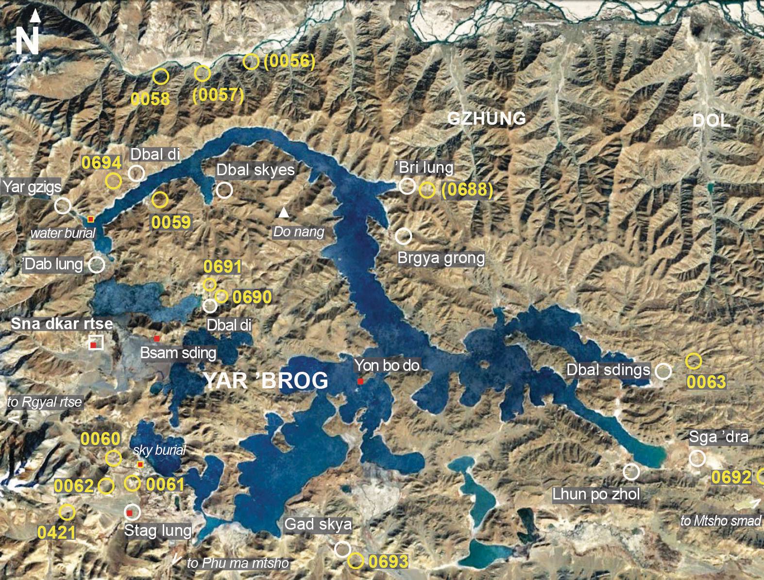
Fig. 11: The burial mound sites in the Yar 'brog region of Sna dkar rtse County (Satellite Photo: Google, Maxar Technologies 2022 (12/16/2013); edited by Hazod 2022)

