ru lag ("additional" horn)

Map Hazod 2009
Fig. 1 Upper and Lower Myang, the area of the two Ru lag smad districts of Myang ro and Khri thang (cf. Hazod 2009: 207, 211)
Fig. 1: Upper and Lower Myang, the area of the two Ru lag smad districts of Myang ro and Khri thang (cf. Hazod 2009: 207, 211) (Map Hazod 2009)

Map Hazod 2009
Fig. 2 The core area of Upper Ru lag and its four military districts (cf. Hazod 2009:210)
Fig. 2: The core area of Upper Ru lag and its four military districts (cf. Hazod 2009:210) (Map Hazod 2009)
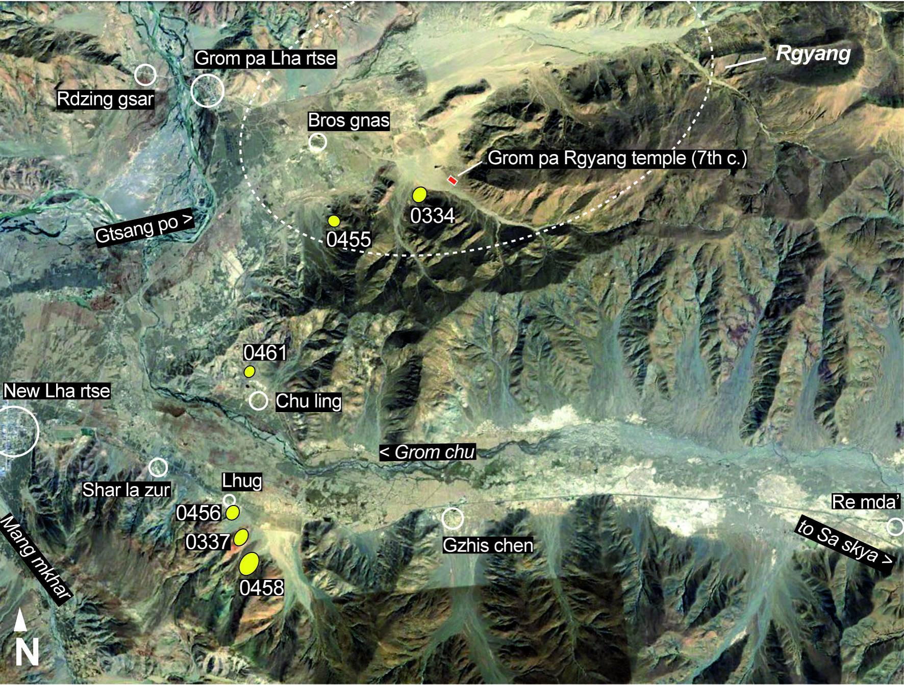
Satellite Photo: Google|DigitalGlobe (04/2015), edited by Hazod 2017
Fig. 3 The grave fields (yellow symbol) in the central part of the ancient Grom pa district (Lha rtse County)
Fig. 3: The grave fields (yellow symbol) in the central part of the ancient Grom pa district (Lha rtse County) (Satellite Photo: Google|DigitalGlobe (04/2015), edited by Hazod 2017)
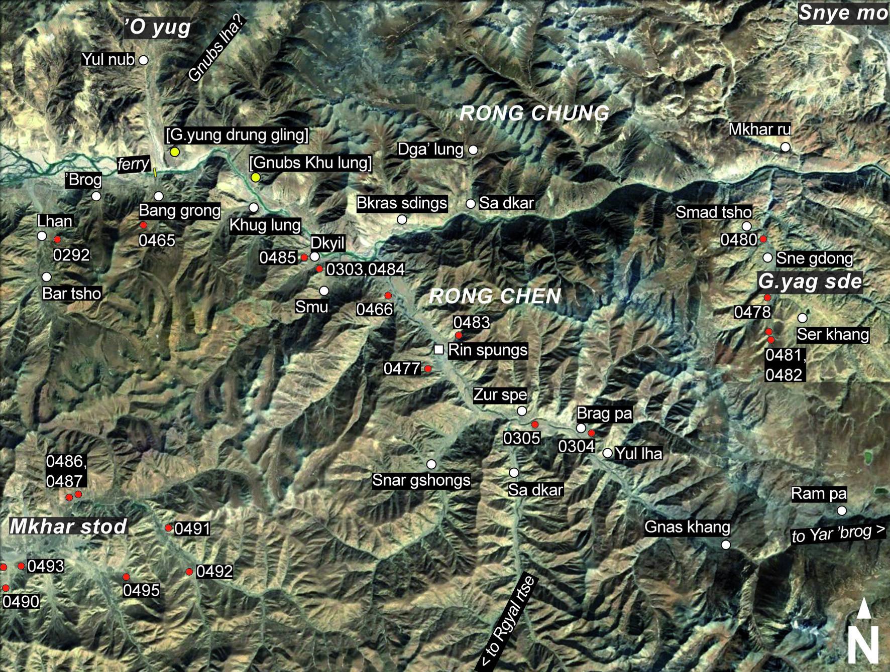
Satellite Photo: Digital Globe (10/2016), edited by Hazod 2017
Fig. 4 The area of Gtsang Rong and its burial mound sites (= red symbol)
Fig. 4: The area of Gtsang Rong and its burial mound sites (= red symbol) (Satellite Photo: Digital Globe (10/2016), edited by Hazod 2017)
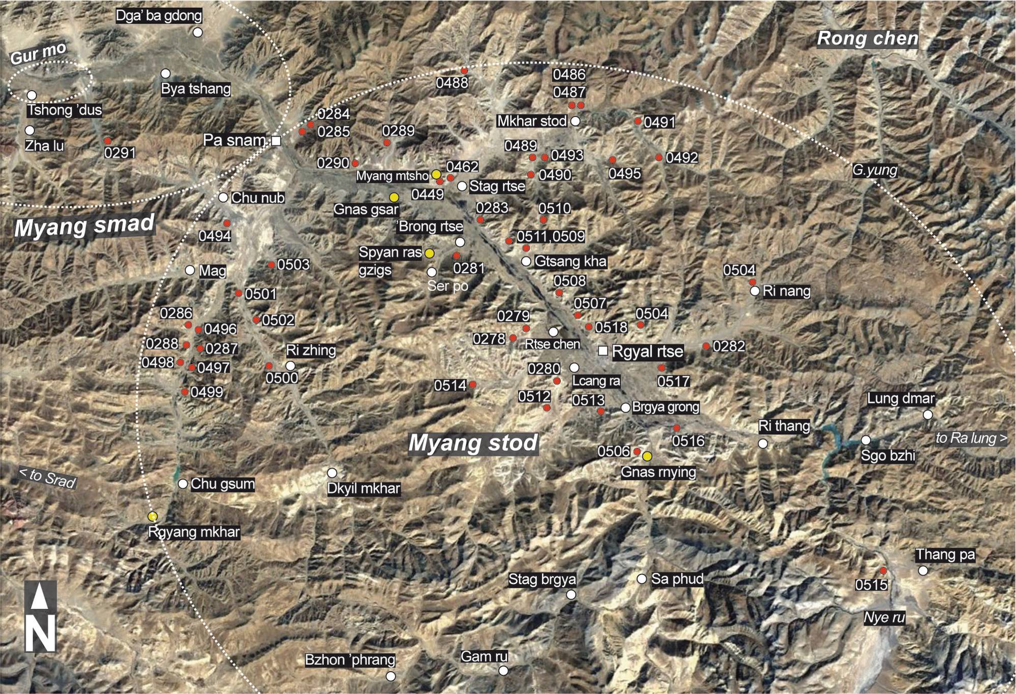
Satellite Photo: Google/DigitalGlobe (11/2011); edited by Hazod 2017
Fig. 5 The burial mounds of Upper and Lower Myang (Rgyal rtse and Pa snam County; red symbol = burial mound sites; yellow symbol = religious sites from the imperial period)
Fig. 5: The burial mounds of Upper and Lower Myang (Rgyal rtse and Pa snam County; red symbol = burial mound sites; yellow symbol = religious sites from the imperial period) (Satellite Photo: Google/DigitalGlobe (11/2011); edited by Hazod 2017)