#0076: Rgyal mkhar thang [Major Site]
- Town/Township
- Shag lho
- Coordinates
- 29°05'07", 92°12'08"
- Elevation
- 3990m
- Field Type
- FT-A
- Mound Type
- MT-C (80m)
- Additional Classification
- major site, elite site
- Status
- v(2005)

Satellite Photo: Google|DigitalGlobe (02/2009)
Fig. 1
Fig. 1: (Satellite Photo: Google|DigitalGlobe (02/2009))
Satellite Photo: Google|DigitalGlobe (02/2009)
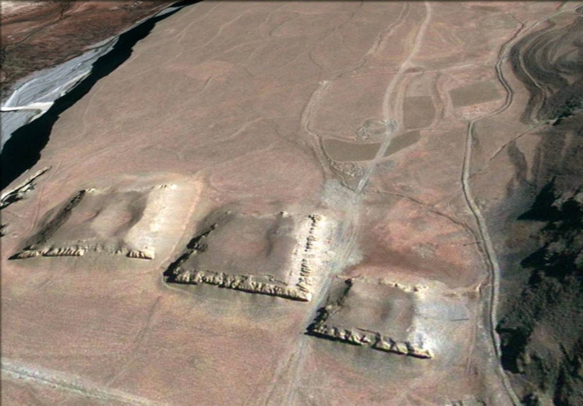
Fig. 2
Fig. 2: (Satellite Photo: Google|DigitalGlobe (02/2009))
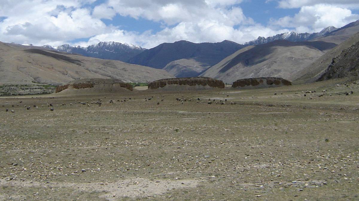
Photo: G. Hazod 2005
Fig. 3
Fig. 3: (Photo: G. Hazod 2005)
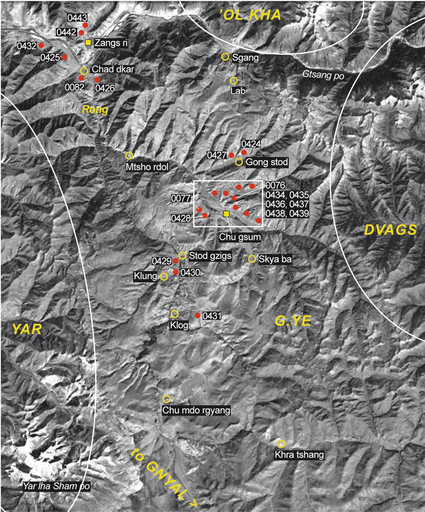
Satellite Photo: Google|DigitalGlobe (02/2009); edited by G. Hazod 2017
Fig. 4 The burial mounds in the ancient territory of G.ye.
Fig. 4: The burial mounds in the ancient territory of G.ye. (Satellite Photo: Google|DigitalGlobe (02/2009); edited by G. Hazod 2017)

Satellite Photo: Google|DigitalGlobe (02/2009); edited by G. Hazod 2017
Fig. 5 The grave fields around Lha Rgya ri in central G.ye.
Fig. 5: The grave fields around Lha Rgya ri in central G.ye. (Satellite Photo: Google|DigitalGlobe (02/2009); edited by G. Hazod 2017)
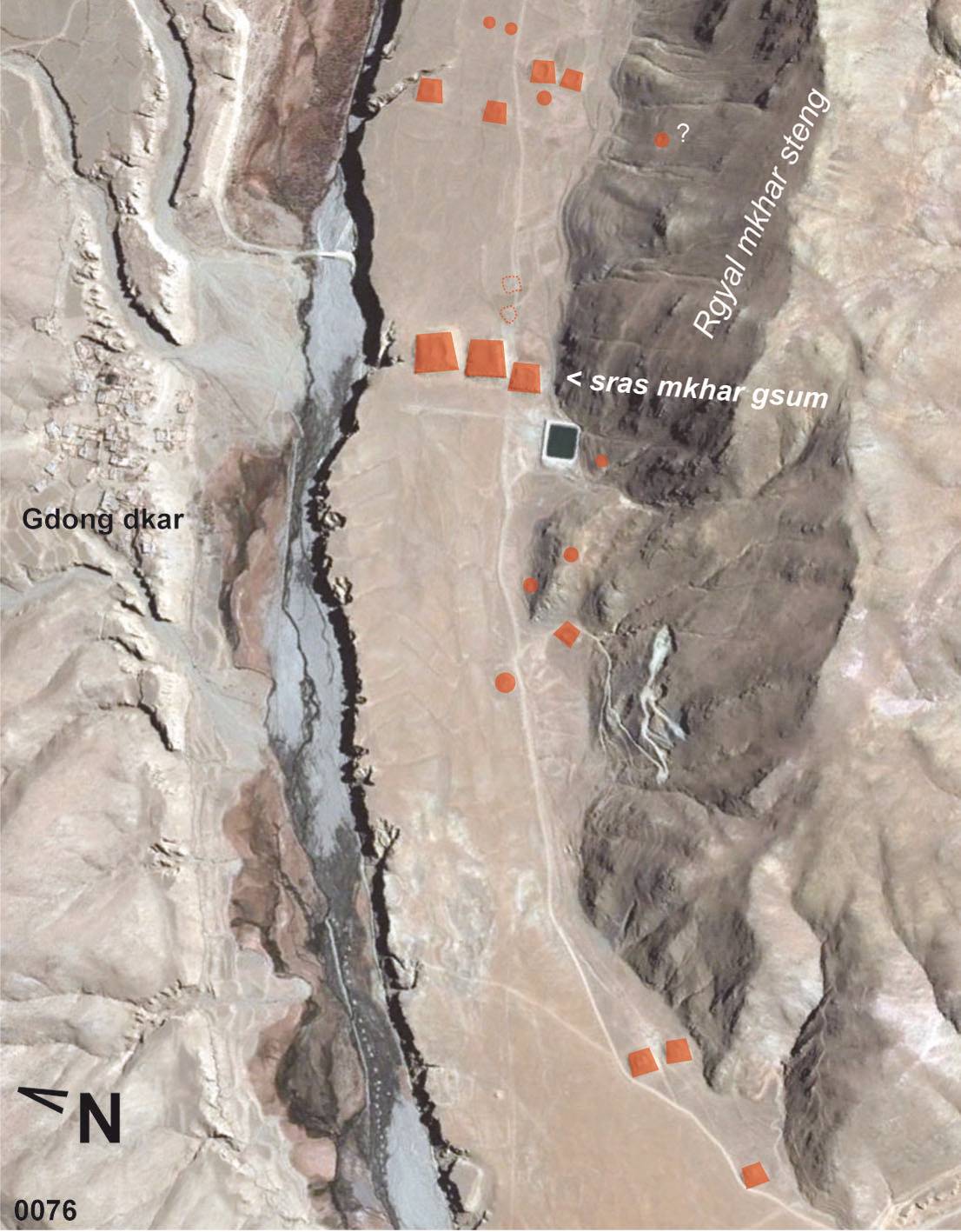
Satellite Photo: Google|DigitalGlobe (02/2009); edited by G. Hazod 2017
Fig. 6 The Burial mound site of Rgyal mkhar thang (#0076) in central G.ye.
Fig. 6: The Burial mound site of Rgyal mkhar thang (#0076) in central G.ye. (Satellite Photo: Google|DigitalGlobe (02/2009); edited by G. Hazod 2017)
Satellite Photo: Google|DigitalGlobe (02/2009); edited by G. Hazod 2017
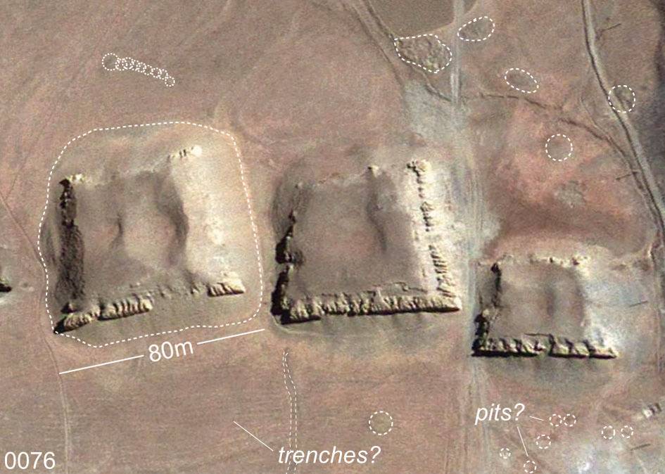
Fig. 7 The tombs of the 'Three "Princes‘. Section of the field of Rgya mkhar thang, #0076.
Fig. 7: The tombs of the 'Three "Princes‘. Section of the field of Rgya mkhar thang, #0076. (Satellite Photo: Google|DigitalGlobe (02/2009); edited by G. Hazod 2017)