#0124: Rgya ma-4
- Town/Township
- Rgya ma
- Coordinates
- 29°46'26", 91°40'29"
- Elevation
- 4010m
- Field Type
- FT-A
- Mound Type
- MT-A
- Status
- nv(sat)
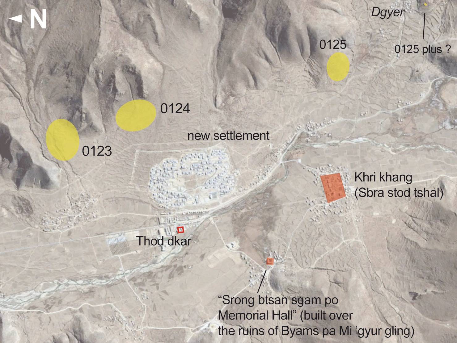
Satellite Photo: Google|DigitalGlobe (12/2014); edited by G. Hazod 2019
Fig. 1 Map of Central Rgya ma (#0123, #124, #0125).
Fig. 1: Map of Central Rgya ma (#0123, #124, #0125). (Satellite Photo: Google|DigitalGlobe (12/2014); edited by G. Hazod 2019)
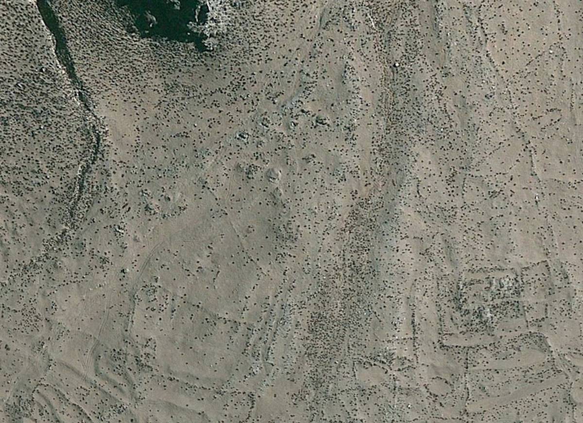
Satellite Photo: Google|DigitalGlobe (12/2010)
Fig. 2
Fig. 2: (Satellite Photo: Google|DigitalGlobe (12/2010))

Photo: G. Hazod 2019
Fig. 3 The petroglyphs of Tsi tsi rong in Upper Rgya ma (cf. Hazod 2014 for details).
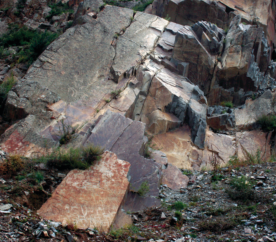
Fig. 3: The petroglyphs of Tsi tsi rong in Upper Rgya ma (cf. Hazod 2014 for details). (Photo: G. Hazod 2019)