#0187: Dbu ru lung [Major Site]
- Town/Township
- Kong thang
- Coordinates
- 30°21'09", 91°03'35"
- Elevation
- 4275m
- Field Type
- FT-A
- Mound Type
- MT-A, MT-C (35m)
- Additional Classification
- major site
- Status
- v(2010, 2013)
Satellite Photo: Google, Maxar Technologies 2023 (12/2005); edited by Hazod 2023
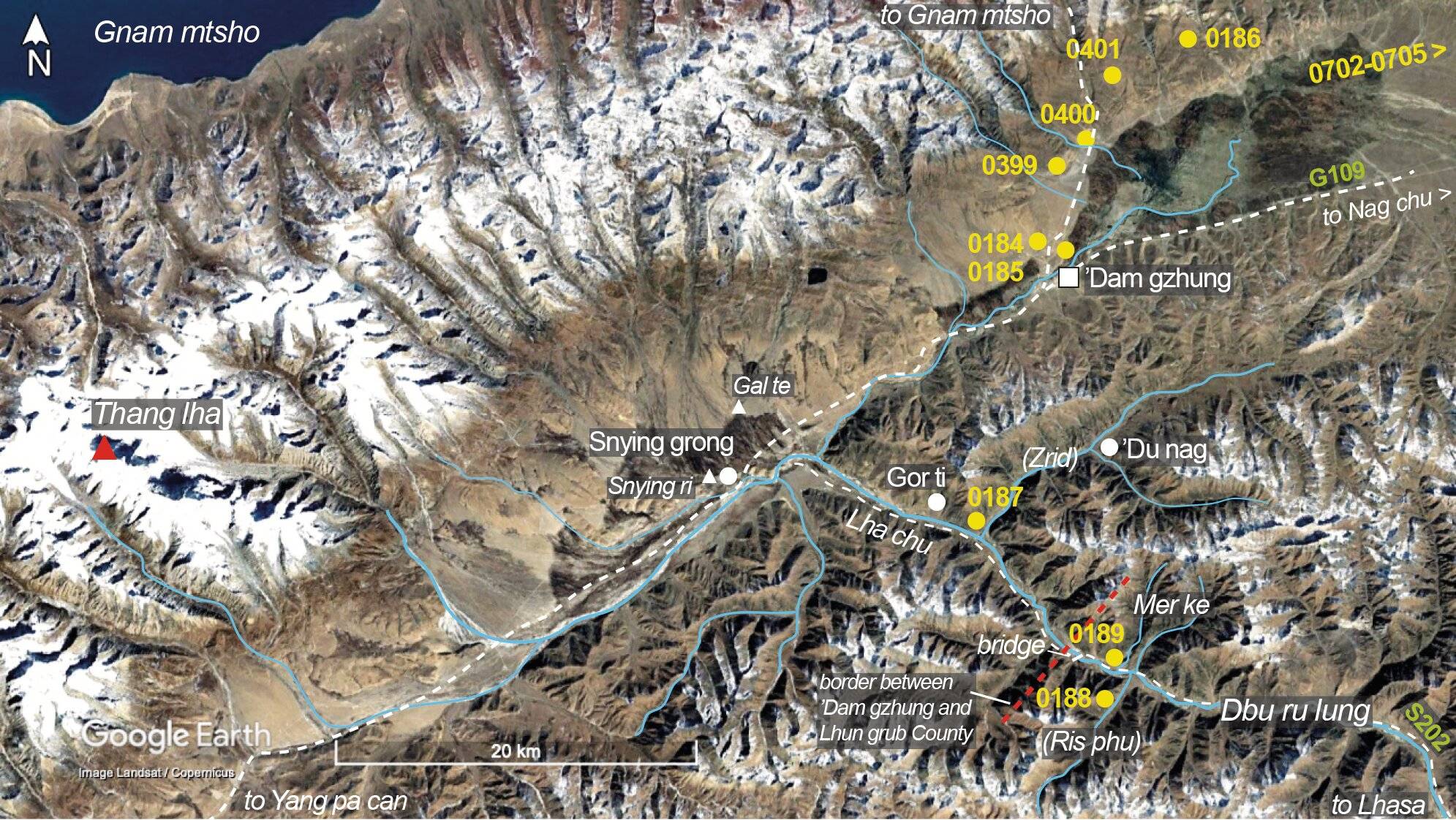
Fig. 1 The burial mound sites of ’Dam gzhung County.
Fig. 1: The burial mound sites of ’Dam gzhung County. (Satellite Photo: Google, Maxar Technologies 2023 (12/2005); edited by Hazod 2023)
Satellite Photo: Google, Maxar Technologies 2023 (03/2010); edited by Hazod 2023
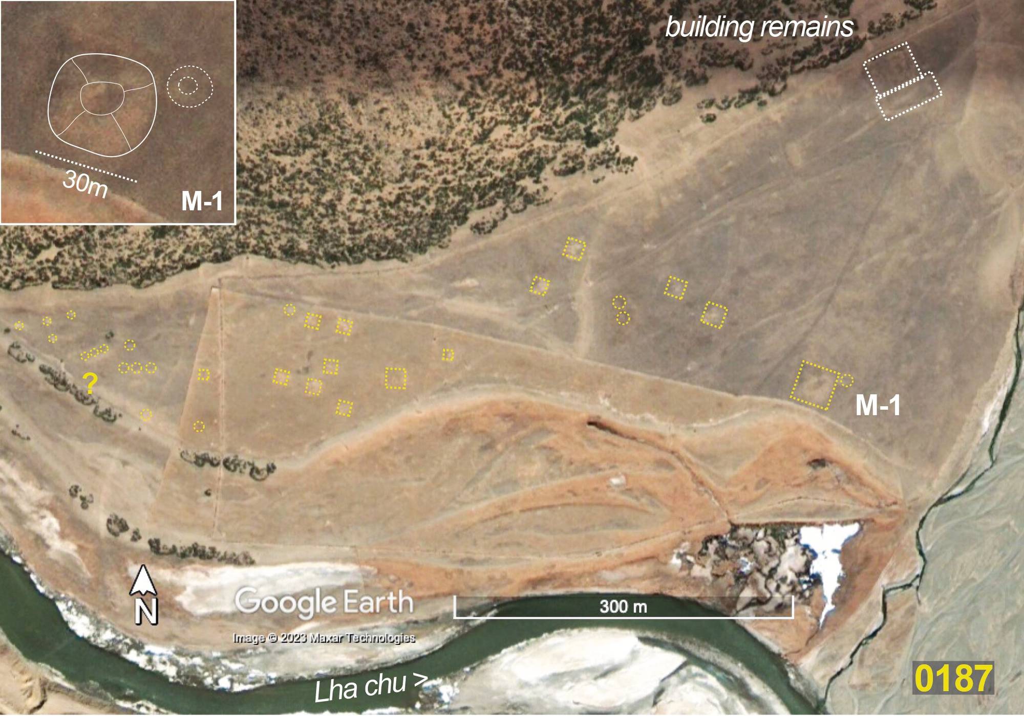
Fig. 2 The site of #0187 at the entrance of the Spra kha ’dam valley, the area of former Zrid mda’.
Fig. 2: The site of #0187 at the entrance of the Spra kha ’dam valley, the area of former Zrid mda’. (Satellite Photo: Google, Maxar Technologies 2023 (03/2010); edited by Hazod 2023)
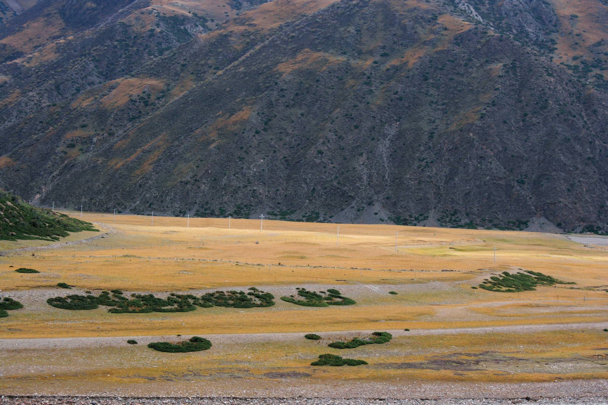
Photo: Hazod 2010
Fig. 3 The tombs of #0187.
Fig. 3: The tombs of #0187. (Photo: Hazod 2010)
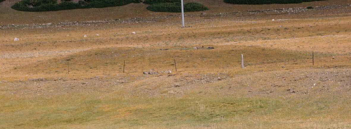
Photo: Hazod 2010
Fig. 4 The central mound M-1 of 0187.
Fig. 4: The central mound M-1 of 0187. (Photo: Hazod 2010)
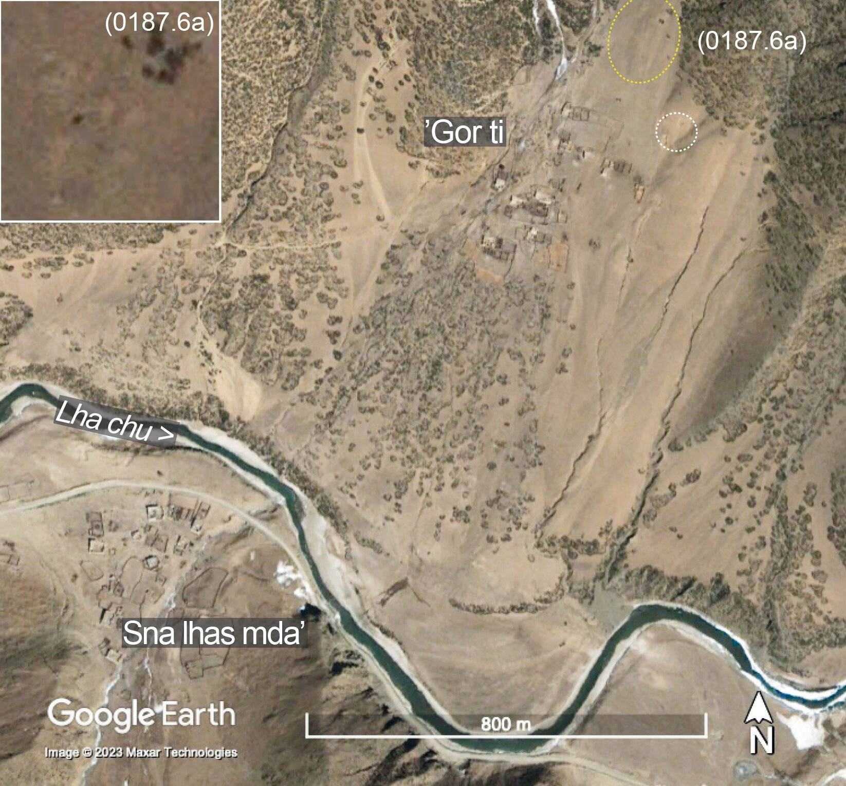
Satellite Photo: Google, Maxar Technologies 2023 (02/2010); edited by Hazod 2023
Fig. 5 ’Gor ti in upper Dbu ru lung.
Fig. 5: ’Gor ti in upper Dbu ru lung. (Satellite Photo: Google, Maxar Technologies 2023 (02/2010); edited by Hazod 2023)
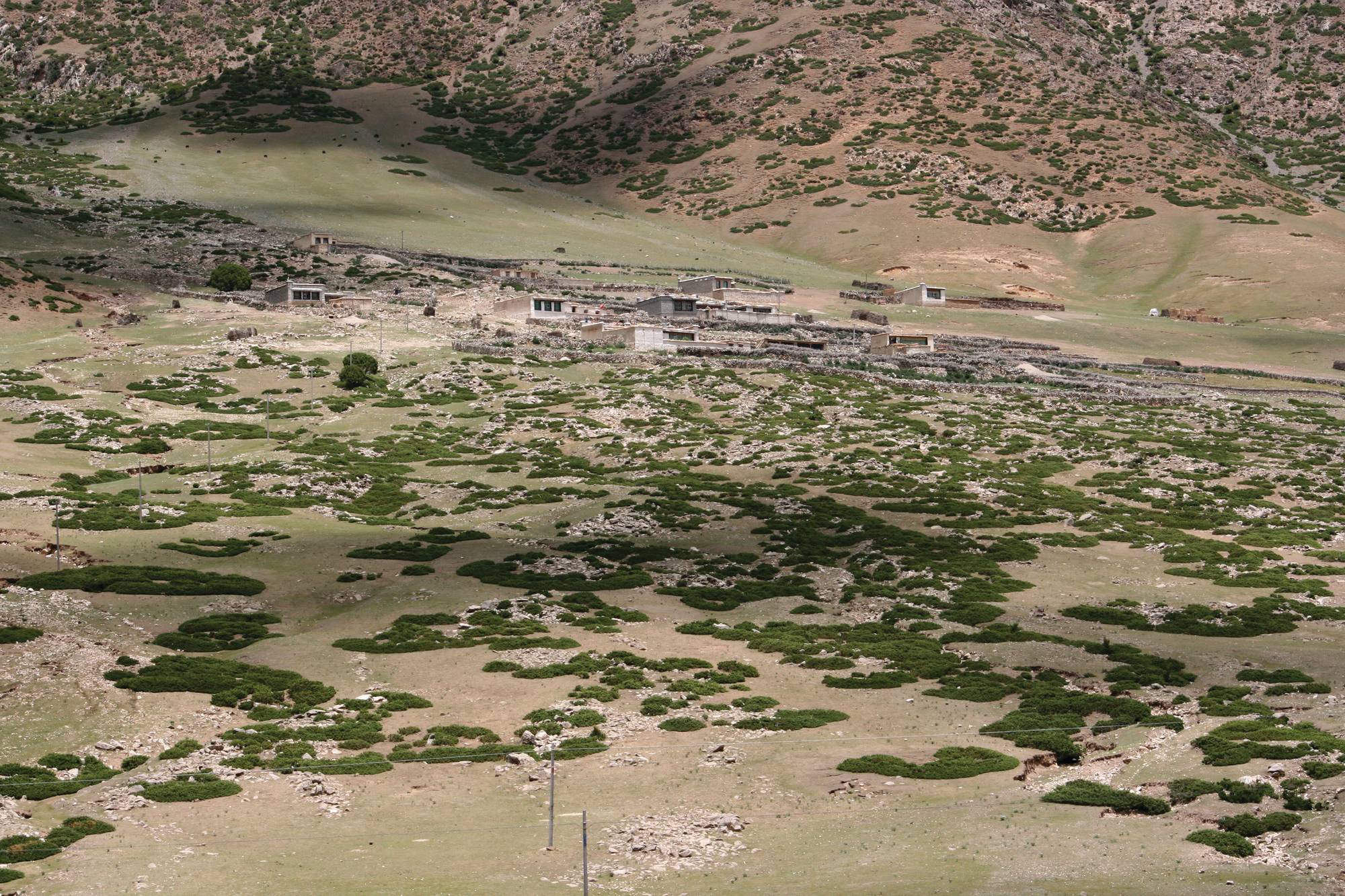
Photo: Hazod 2010
Fig. 6 The village of ’Gor ti.
Fig. 6: The village of ’Gor ti. (Photo: Hazod 2010)