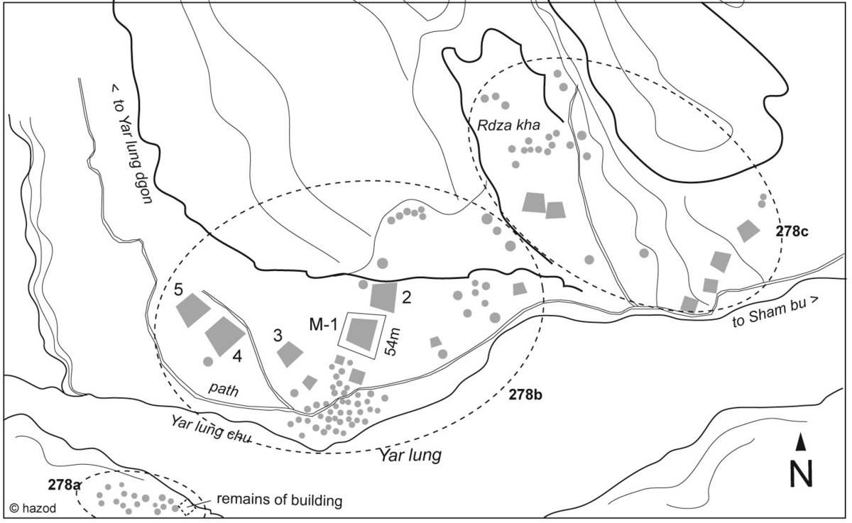
#0278: Sham bu-1 [Major Site]
- Town/Township
- Rtse chen
- Coordinates
- 28°55'51", 89°30'26"
- Elevation
- 4070m
- Field Type
- FT-A
- Mound Type
- MT-A, MT-C (55m)
- Additional Classification
- major site
- Status
- v(2007, 2009)
Satellite Photo: Google|DigitalGlobe (11/2011); edited by G. Hazod 2017
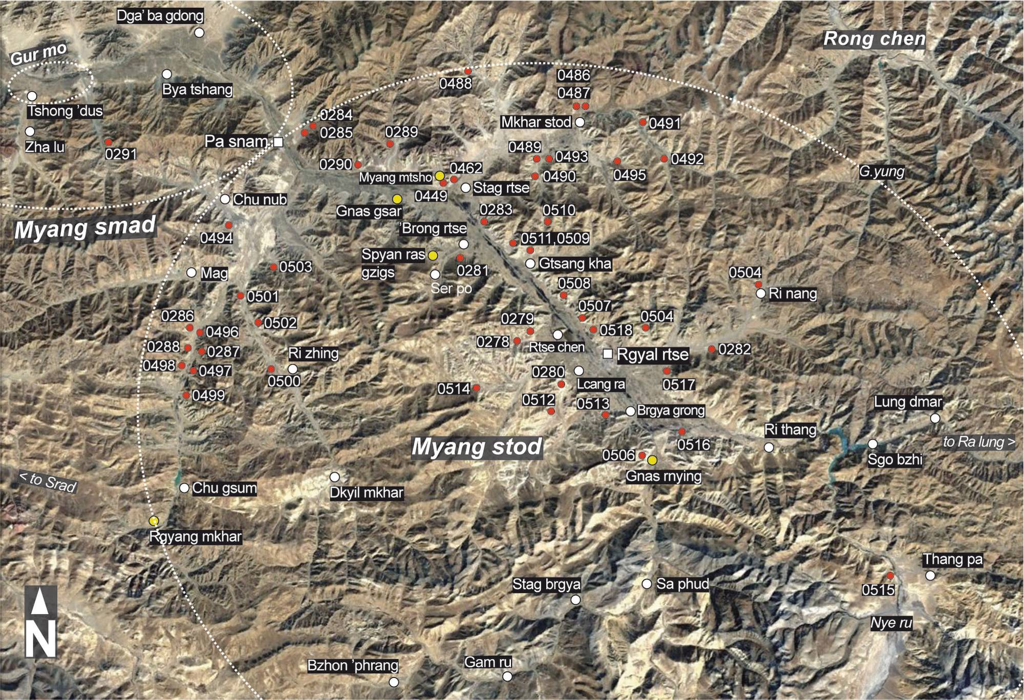
Fig. 1 The burial mounds of Upper and Lower Myang (Rgyal rtse and Pa snam County; red symbol = burial mound sites; yellow symbol = religious sites from the imperial period).
Fig. 1: The burial mounds of Upper and Lower Myang (Rgyal rtse and Pa snam County; red symbol = burial mound sites; yellow symbol = religious sites from the imperial period). (Satellite Photo: Google|DigitalGlobe (11/2011); edited by G. Hazod 2017)
Satellite Photo: Google|DigitalGlobe (12/2010); edited by G. Hazod 2013
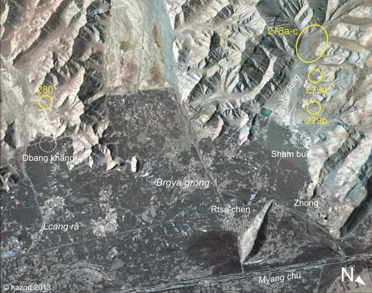
Fig. 2 Around Rtse chen, the core area of ancient Myang ro Sham po.
Fig. 2: Around Rtse chen, the core area of ancient Myang ro Sham po. (Satellite Photo: Google|DigitalGlobe (12/2010); edited by G. Hazod 2013)
Satellite Photo: Google|DigitalGlobe (02/2006)
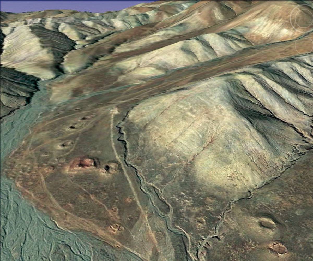
Fig. 3
Fig. 3: (Satellite Photo: Google|DigitalGlobe (02/2006))
Map: G. Hazod 2009, 2013
Fig. 4
Fig. 4: (Map: G. Hazod 2009, 2013)
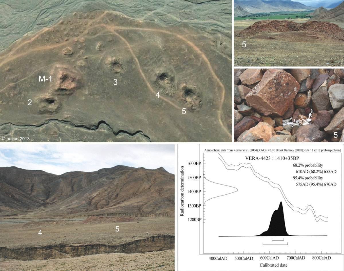
Photo: G. Hazod 2007; Satellite Photo: Google|DigitalGlobe (02/2006); edited by G. Hazod 2009, 2013
Fig. 5 The central part of the fields of Sham bu (#0278b), with the dating of bone finds from M-5. (See Hazod 2009: 187)
Fig. 5: The central part of the fields of Sham bu (#0278b), with the dating of bone finds from M-5. (See Hazod 2009: 187) (Photo: G. Hazod 2007; Satellite Photo: Google|DigitalGlobe (02/2006); edited by G. Hazod 2009, 2013)
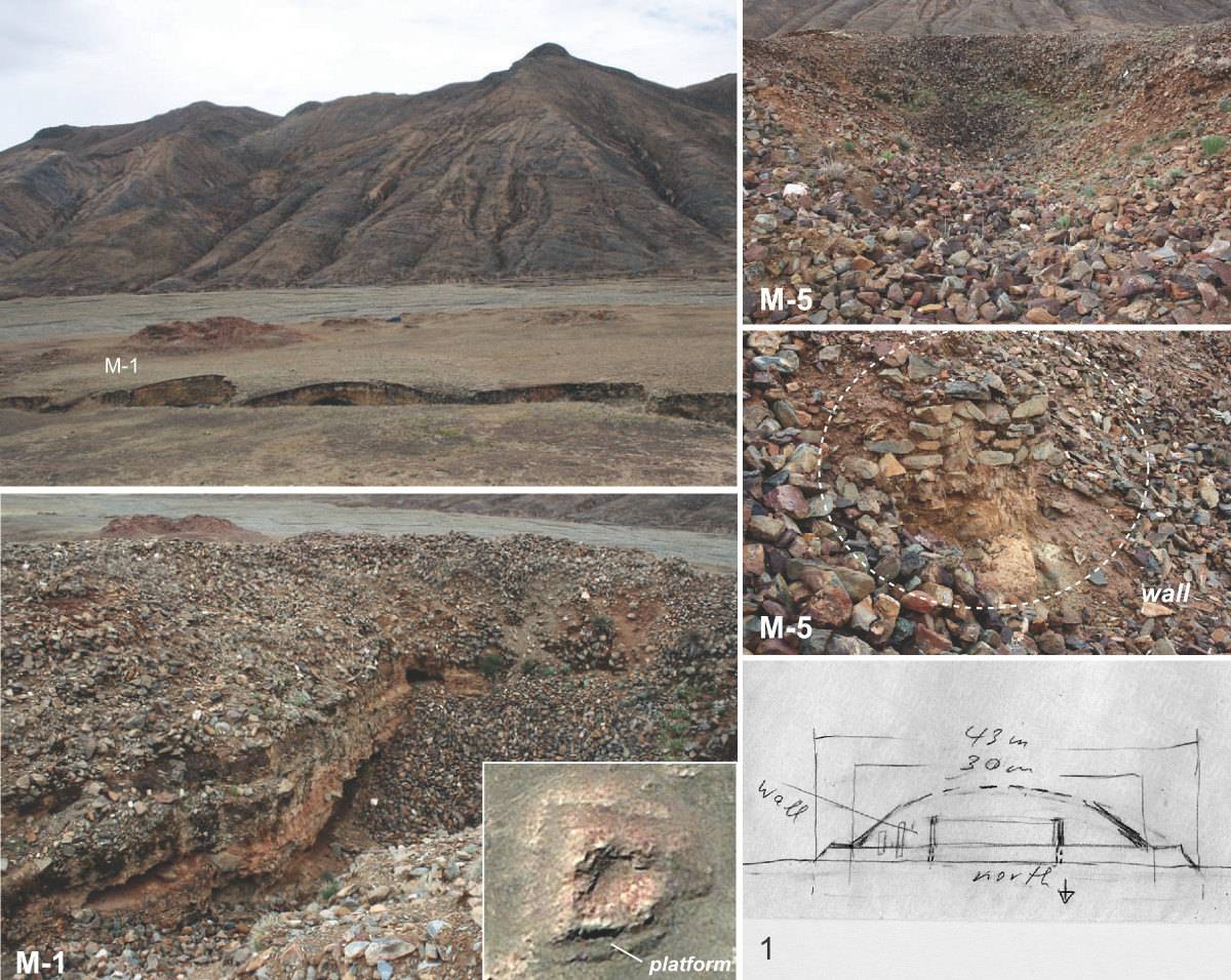
Photo: G. Hazod 2007
Fig. 6 Inside the tombs (#0278, no. 1, 5).
Fig. 6: Inside the tombs (#0278, no. 1, 5). (Photo: G. Hazod 2007)