#0029: Lower Don mkhar-1 [Major Site]
- Town/Township
- ’Phyong rgyas
- Coordinates
- 29°01'31", 91°41'50"
- Elevation
- 3790m
- Field Type
- FT-A
- Mound Type
- MT-C (60m)
- Additional Classification
- major site, royal site
- Status
- v(1995-2013)
See also: https://www.oeaw.ac.at/tibetantumulustradition/thematic-introduction/royal-tombs-2/ and http://www.oeaw.ac.at/tibetantumulustradition/thematic-introduction/royal-tombs-1/
Satellite Photo: Google|DigitalGlobe (01/2011); edited by G. Hazod 2013 & 2016
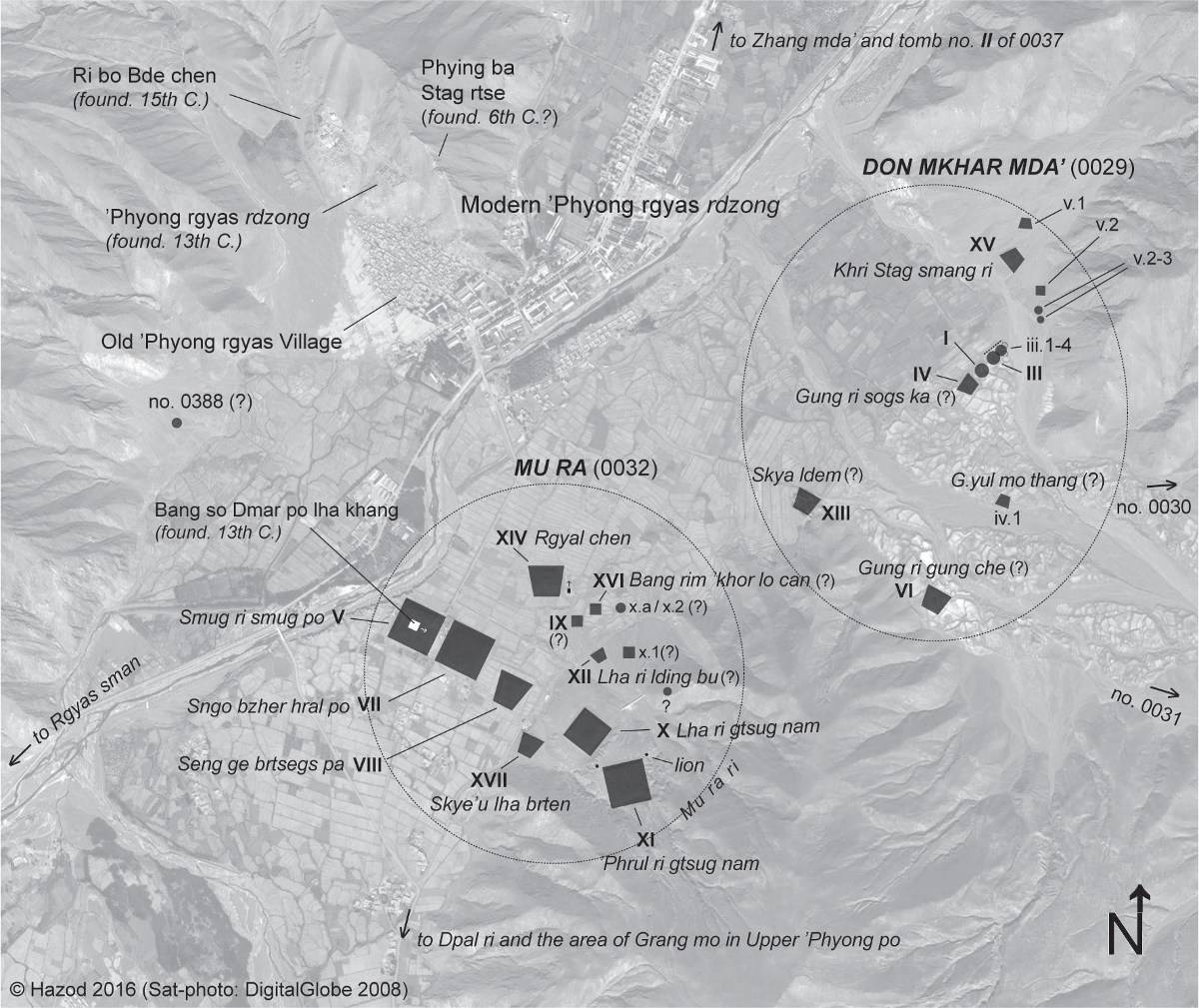
Fig. 1 The Royal Tombs of 'Phyong rgyas. (The names of Tombs follow the details in GYC (c.f. [/thematic-introduction/royal-tombs-2](royal tombs II)); for the symbols see "summarising table" ([/thematic-introduction/royal-tombs-2](royal tombs I).)
Fig. 1: The Royal Tombs of 'Phyong rgyas. (The names of Tombs follow the details in GYC (c.f. [/thematic-introduction/royal-tombs-2](royal tombs II)); for the symbols see "summarising table" ([/thematic-introduction/royal-tombs-2](royal tombs I).) (Satellite Photo: Google|DigitalGlobe (01/2011); edited by G. Hazod 2013 & 2016)
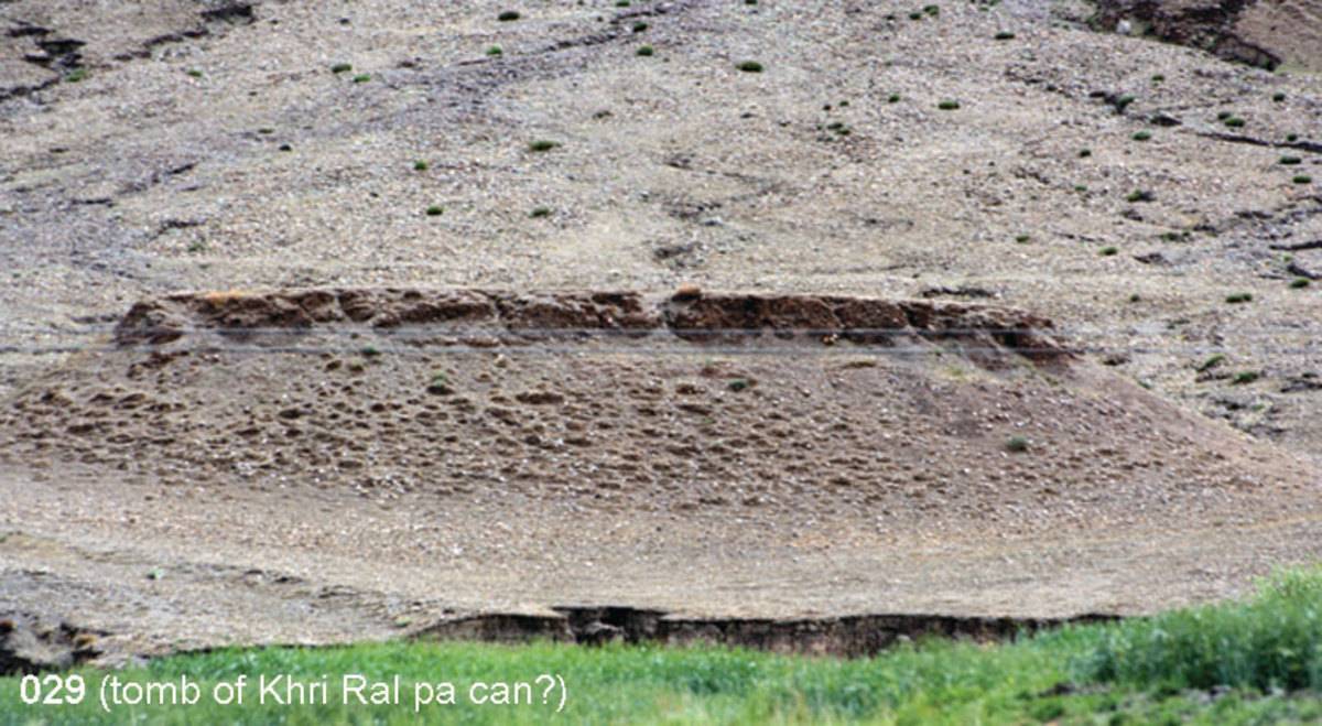
Photo: G. Hazod 2013
Fig. 2 Don mkhar mda' (#0029): tomb of Khri Ral pa can?
Fig. 2: Don mkhar mda' (#0029): tomb of Khri Ral pa can? (Photo: G. Hazod 2013)
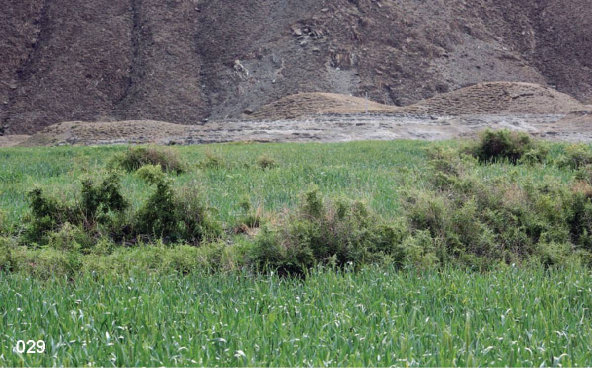
Photo: G. Hazod 2013
Fig. 3
Fig. 3: (Photo: G. Hazod 2013)
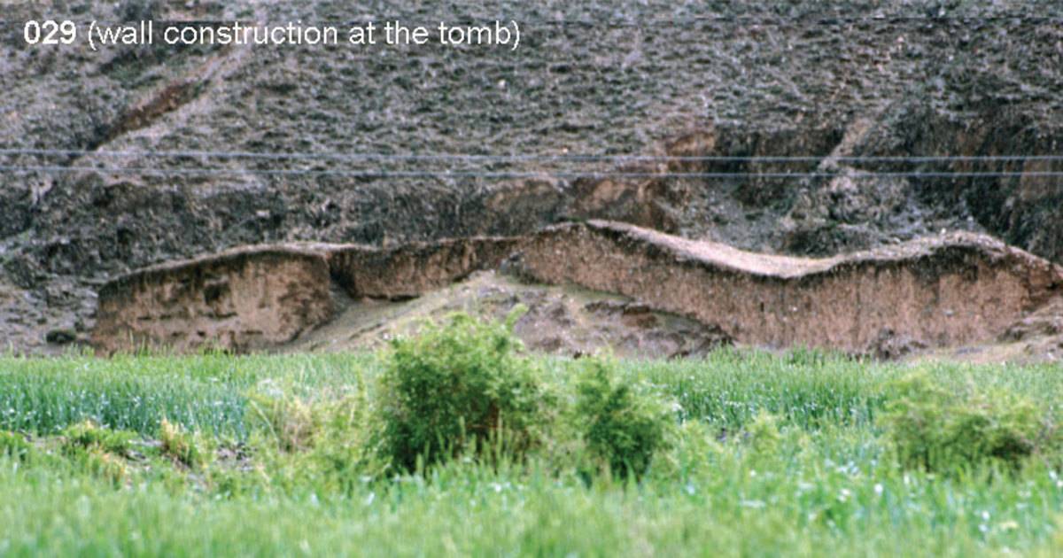
Photo: G. Hazod 2013
Fig. 4 Don mkhar mda' (#0029): wall construction at the tomb.
Fig. 4: Don mkhar mda' (#0029): wall construction at the tomb. (Photo: G. Hazod 2013)
Satellite Photo: Google|DigitalGlobe (01/2011); edited by G. Hazod 2011
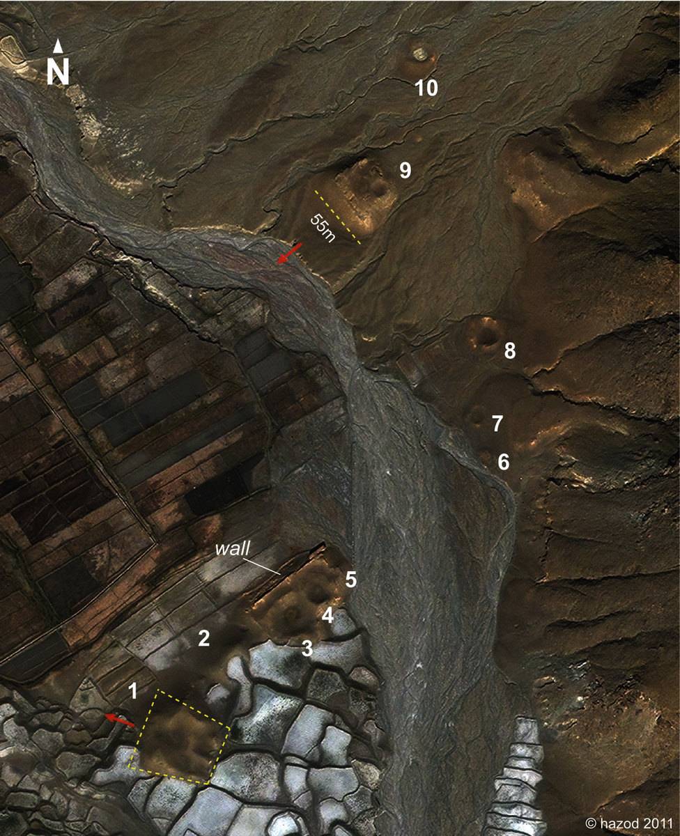
Fig. 5 Don mkhar mda' (#0029): Ten of altogether 13 (or 14) tombs (see Map to field #0032).
Fig. 5: Don mkhar mda' (#0029): Ten of altogether 13 (or 14) tombs (see Map to field #0032). (Satellite Photo: Google|DigitalGlobe (01/2011); edited by G. Hazod 2011)
Satellite Photo: Google|DigitalGlobe (01/2011); edited by G. Hazod 2013
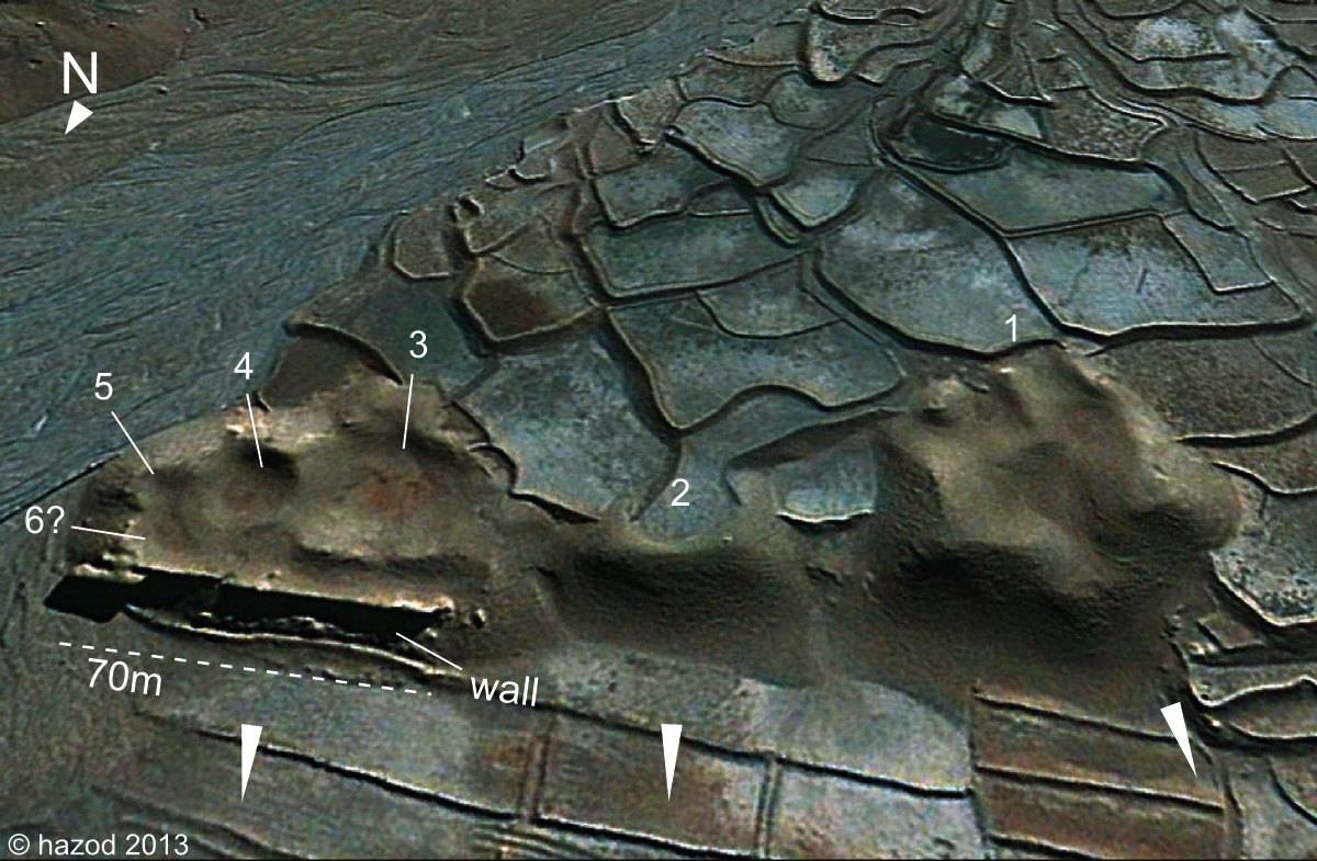
Fig. 6 The central (five / six?) tombs of Don mkhar mda' (#0029).
Fig. 6: The central (five / six?) tombs of Don mkhar mda' (#0029). (Satellite Photo: Google|DigitalGlobe (01/2011); edited by G. Hazod 2013)
Photos: G. Hazod 2013; Satellite Photo: Google|DigitalGlobe (01/2011); edited by G. Hazod 2013
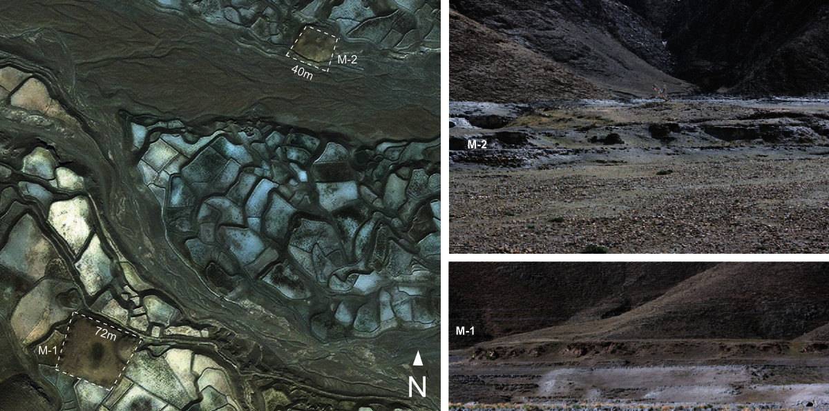
Fig. 7 The two clearly identified burial mounds situated behind the central tombs of Don mkhar mda' (#0029).
Fig. 7: The two clearly identified burial mounds situated behind the central tombs of Don mkhar mda' (#0029). (Photos: G. Hazod 2013; Satellite Photo: Google|DigitalGlobe (01/2011); edited by G. Hazod 2013)
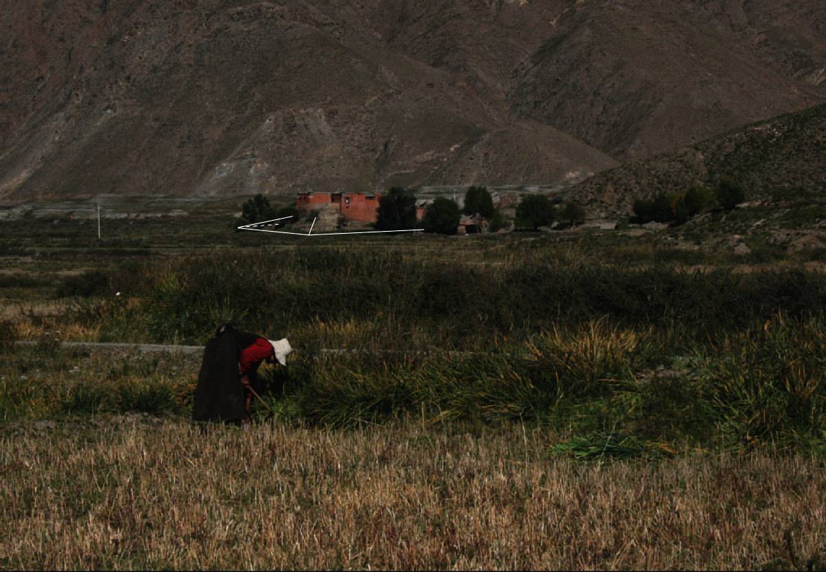
Photo: G. Hazod 2013
Fig. 8 The presumed grave below the farming house in Don mkhar mda' (#0029).
Fig. 8: The presumed grave below the farming house in Don mkhar mda' (#0029). (Photo: G. Hazod 2013)
Satellite Photo: Google|DigitalGlobe (01/2011); edited by G. Hazod 2013
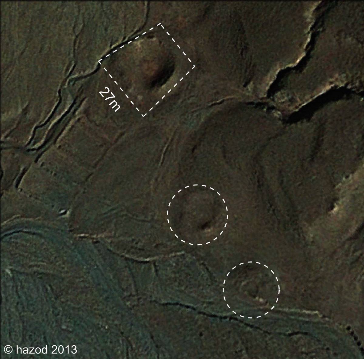
Fig. 9 Three of the smaller graves in Don mkhar mda' (#0029).
Fig. 9: Three of the smaller graves in Don mkhar mda' (#0029). (Satellite Photo: Google|DigitalGlobe (01/2011); edited by G. Hazod 2013)
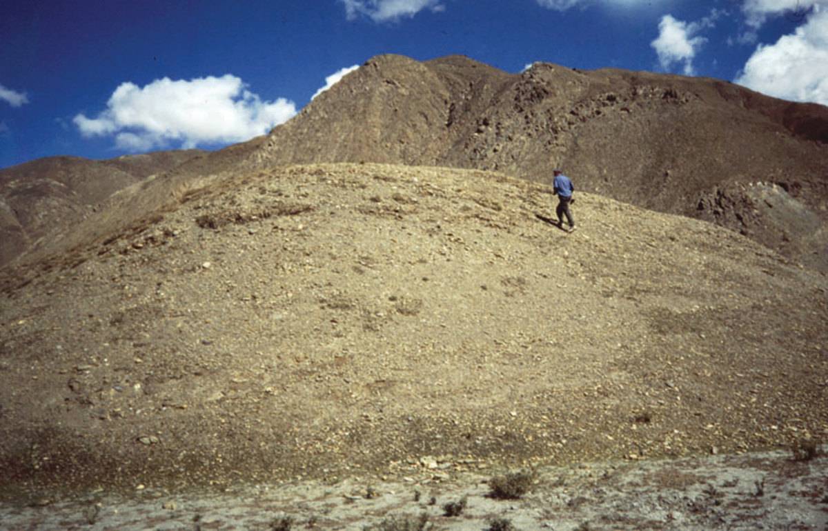
Photo: G. Hazod 1997
Fig. 10
Fig. 10: (Photo: G. Hazod 1997)