#0307: Shab-2
- Town/Township
- Dge sdings
- Coordinates
- 29°07'23", 88°23'38"
- Elevation
- 4005m
- Field Type
- FT-A
- Mound Type
- MT-A
- Additional Classification
- additional mounds in vicinity
- Status
- nv(sat)
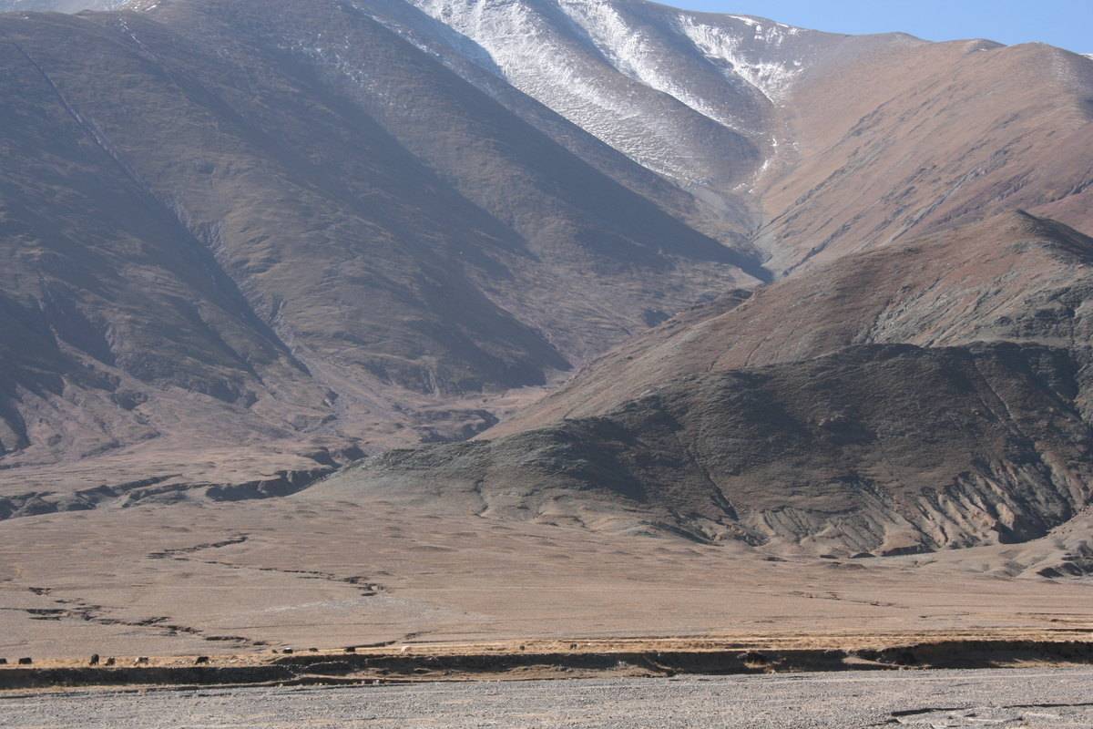
Photo: G. Hazod 2008
Fig. 1 The site of #0307 in the Shab valley; see the map „The Shab valley and neighbouring districts”.
Fig. 1: The site of #0307 in the Shab valley; see the map „The Shab valley and neighbouring districts”. (Photo: G. Hazod 2008)
Satellite Photo: Google|Maxar Technologies 2021 (10/2010); edited by G. Hazod 2021
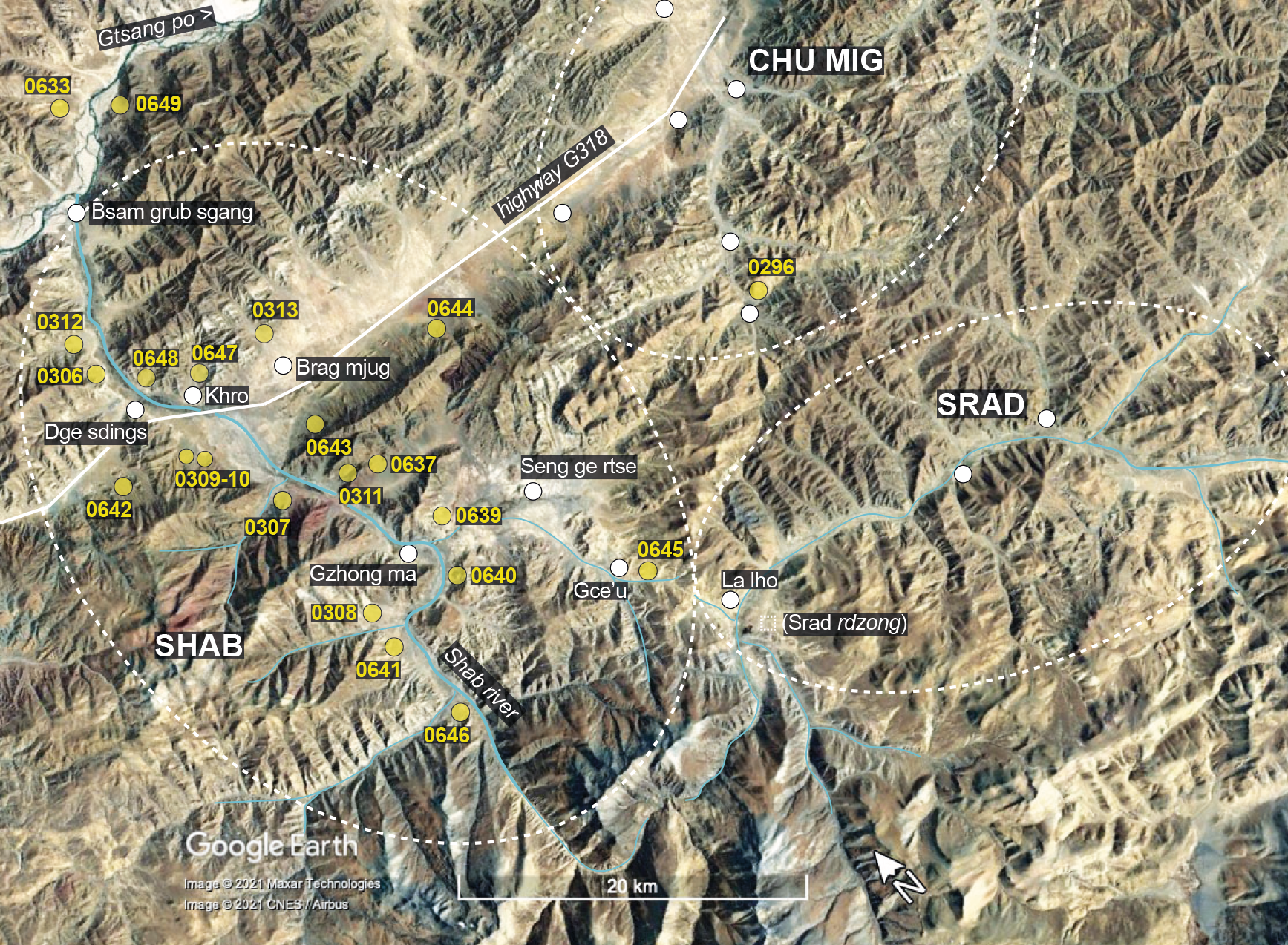
Fig. 2 The Shab valley and neighbouring districts: burial mound sites (= symbols and numbers in yellow) and major settlements.
Fig. 2: The Shab valley and neighbouring districts: burial mound sites (= symbols and numbers in yellow) and major settlements. (Satellite Photo: Google|Maxar Technologies 2021 (10/2010); edited by G. Hazod 2021)