#0339: Khrom chen-1 [Major Site]
- Town/Township
- Chos ma
- Coordinates
- 29°21'33", 87°48'42"
- Elevation
- 4120m
- Field Type
- FT-A
- Mound Type
- MT-C (75-80m)
- Additional Classification
- major site, elite site
- Status
- nv(sat/ref)
Satellite Photo: Google|DigitalGlobe (03/2012); edited by G. Hazod 2013
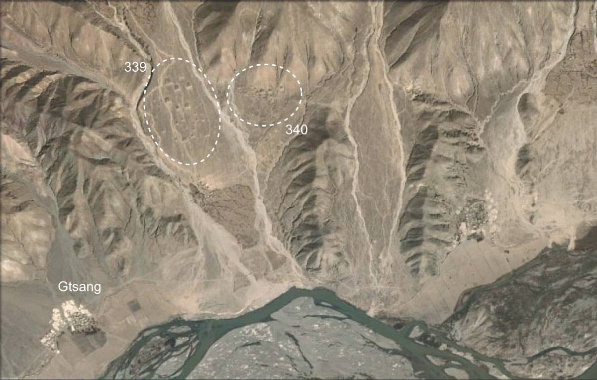
Fig. 1 The fields of Khrom chen (#0339, #0340).
Fig. 1: The fields of Khrom chen (#0339, #0340). (Satellite Photo: Google|DigitalGlobe (03/2012); edited by G. Hazod 2013)
Photograph after CRB 2010 (p. 122, 123); Satellite Photo: Google|DigitalGlobe (03/2012); edited by G. Hazod 2013
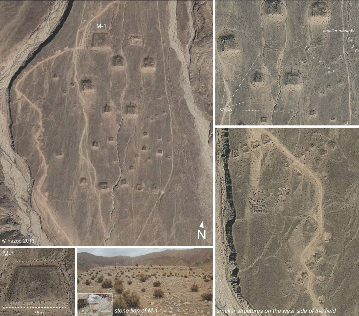
Fig. 2 The main field of Khrom chen (#0339), with altogether c.150 tombs of various size (5-78m). (For a first historical study, see P. Wangdu 1994).
Fig. 2: The main field of Khrom chen (#0339), with altogether c.150 tombs of various size (5-78m). (For a first historical study, see P. Wangdu 1994). (Photograph after CRB 2010 (p. 122, 123); Satellite Photo: Google|DigitalGlobe (03/2012); edited by G. Hazod 2013)
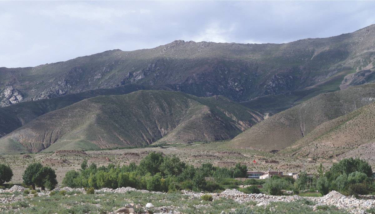
Photo: S. Khacham 2011
Fig. 3 The field of #0339.
Fig. 3: The field of #0339. (Photo: S. Khacham 2011)
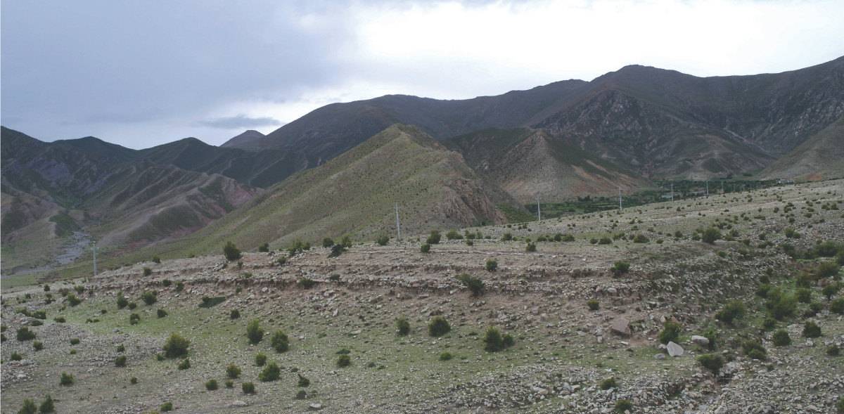
Photo: S. Khacham 2011
Fig. 4 M-1 of #0339.
Fig. 4: M-1 of #0339. (Photo: S. Khacham 2011)
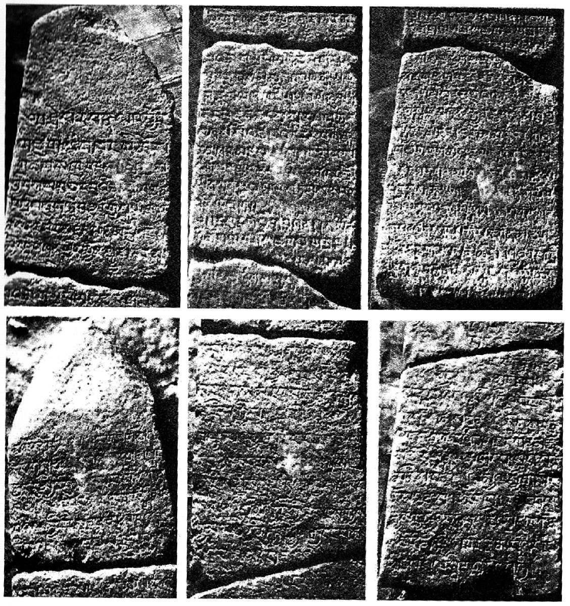
Photo: after XWD, p. 123
Fig. 5 The fragments of the Khrom chen rdo ring.The stele was originally erected at the rear side on top of M-1 and is currently said to be kept in Lhatse township (Huo Wei 2010c).
Fig. 5: The fragments of the Khrom chen rdo ring.The stele was originally erected at the rear side on top of M-1 and is currently said to be kept in Lhatse township (Huo Wei 2010c). (Photo: after XWD, p. 123)
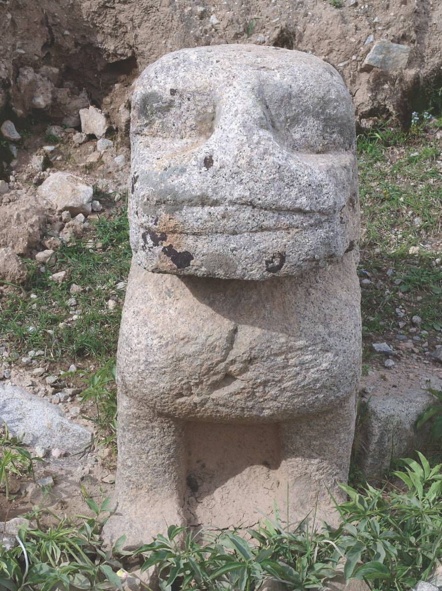
Photo: S. Khacham 2011
Fig. 6 One of the two stone lions situated at the corners of #0339.M-1.
Fig. 6: One of the two stone lions situated at the corners of #0339.M-1. (Photo: S. Khacham 2011)
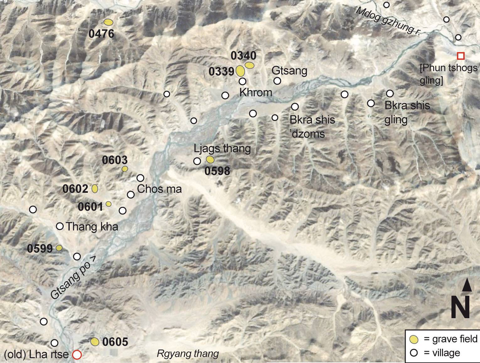
Map based on sat-photo 10/2007; DigitalGlobe 2018
Fig. 7 The burial mound sites registered for the old Lha rtse district (stong sde) of Upper Ru lag (Jan. 2019)
Fig. 7: The burial mound sites registered for the old Lha rtse district (stong sde) of Upper Ru lag (Jan. 2019) (Map based on sat-photo 10/2007; DigitalGlobe 2018)