#0425: Klu khang
- Town/Township
- Rong
- Coordinates
- 29°14'27", 91°59'25"
- Elevation
- 3630m
- Field Type
- FT-A
- Mound Type
- MT-A
- Status
- nv(sat)

Satellite Photo: Google|Maxar Technologies 2020 (12/2010 & 02/2009); edited by G. Hazod 2021
Fig. 1
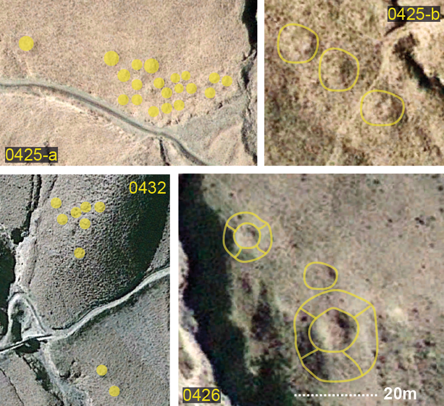
Fig. 1: (Satellite Photo: Google|Maxar Technologies 2020 (12/2010 & 02/2009); edited by G. Hazod 2021)
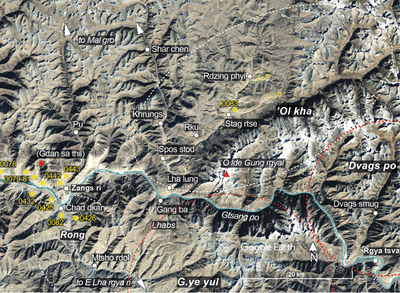
Satellite Photo: Google|Maxar Technologies 2020 (12/2010); edited by G. Hazod 2021
Fig. 2 The areas of Zang sri County: Rong, ’Ol kha and the area around Zangs ri. The numbers in yellow refer to the burial mound sites in this region.
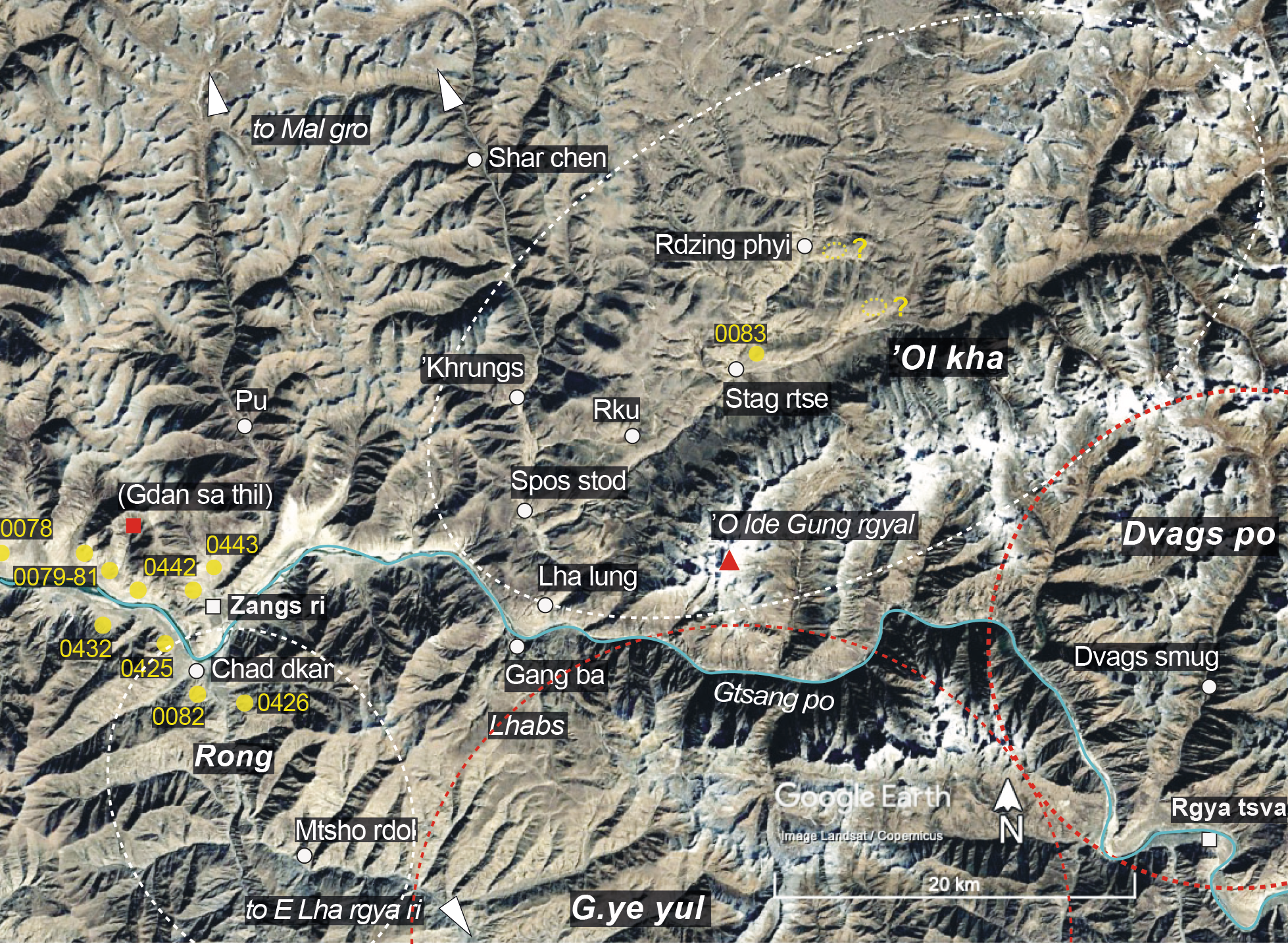
Fig. 2: The areas of Zang sri County: Rong, ’Ol kha and the area around Zangs ri. The numbers in yellow refer to the burial mound sites in this region. (Satellite Photo: Google|Maxar Technologies 2020 (12/2010); edited by G. Hazod 2021)

Satellite Photo: Google|Maxar Technologies 2020 (12/2010); edited by G. Hazod 2021
Fig. 3 The central part of Zangs ri.
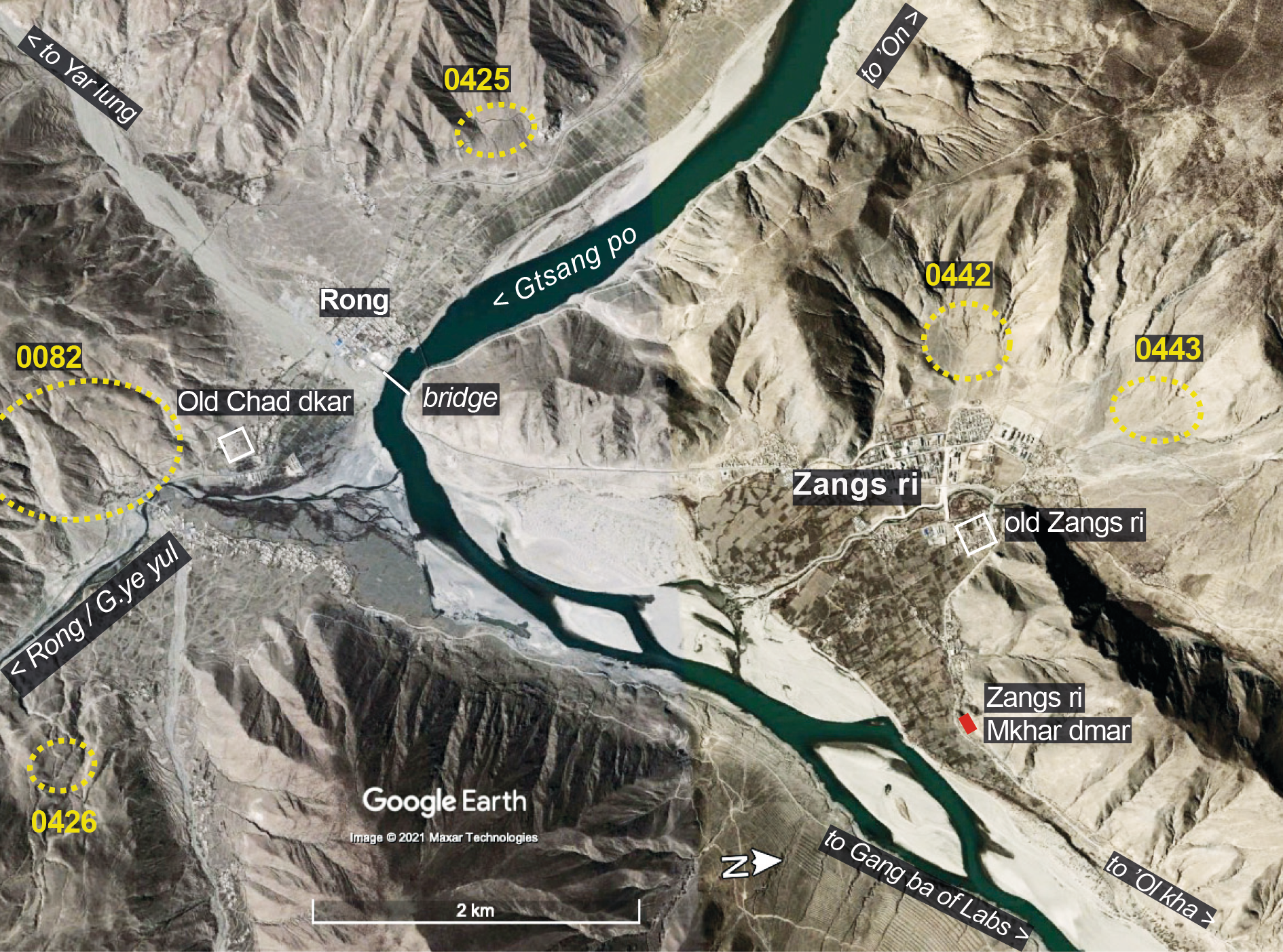
Fig. 3: The central part of Zangs ri. (Satellite Photo: Google|Maxar Technologies 2020 (12/2010); edited by G. Hazod 2021)