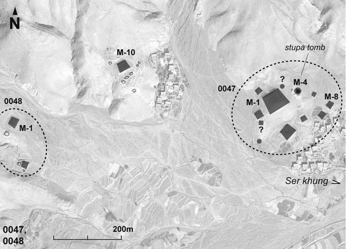
#0047: Bde sdu-1 (Ser khung) [Major Site]
- Town/Township
- Rgyal gling
- Coordinates
- 29°14'02", 91°17'58"
- Elevation
- 3660m
- Field Type
- FT-A, FT-B
- Mound Type
- MT-C, MT-D (70m)
- Additional Classification
- major site, elite site
- Status
- v(2008)
Satellite Photo: Google|DigitalGlobe; edited by G. Hazod 2022
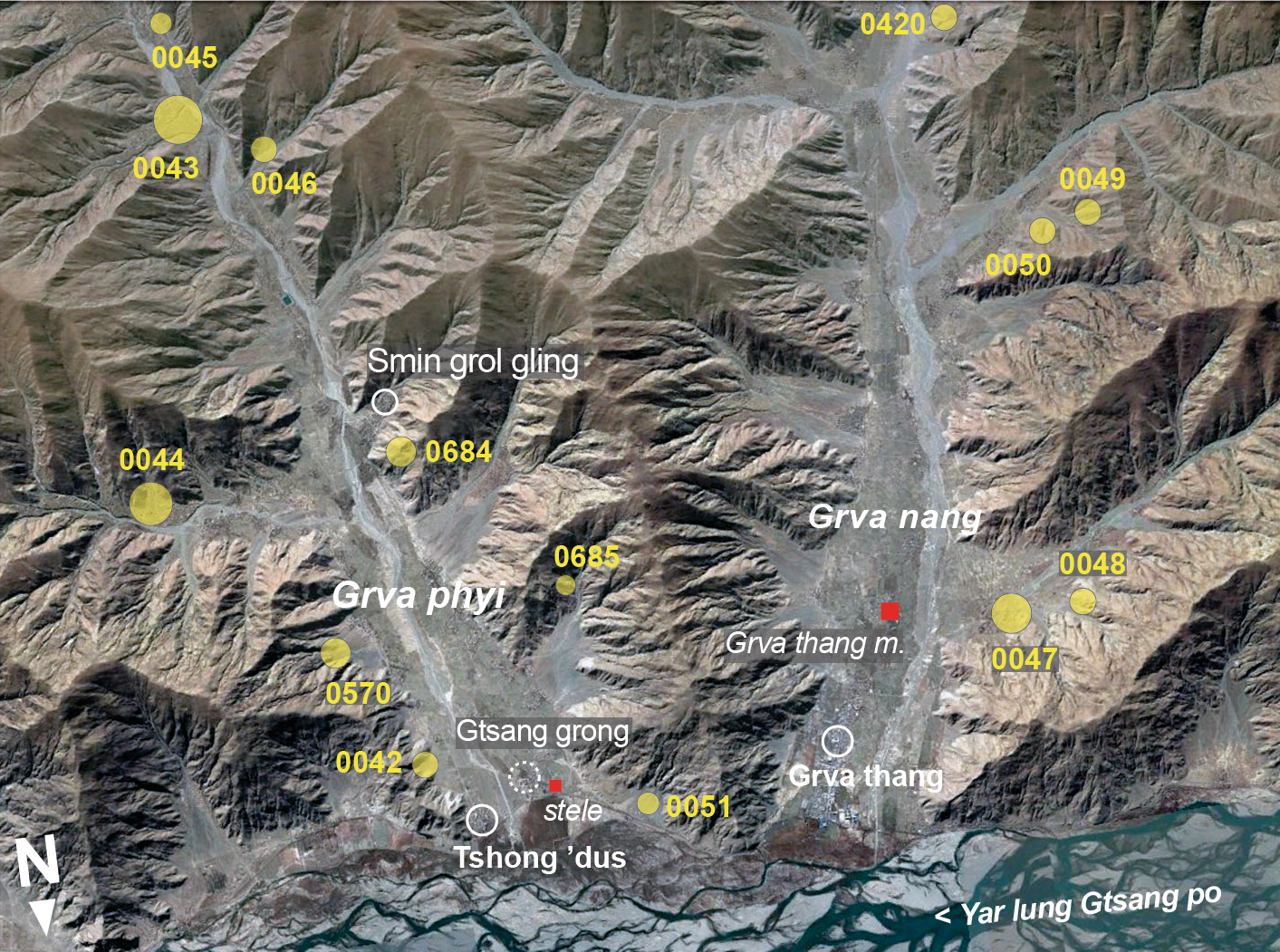
Fig. 1 The grave fields of the Grva district.
Fig. 1: The grave fields of the Grva district. (Satellite Photo: Google|DigitalGlobe; edited by G. Hazod 2022)
Satellite Photo: Google|DigitalGlobe (12/2010)
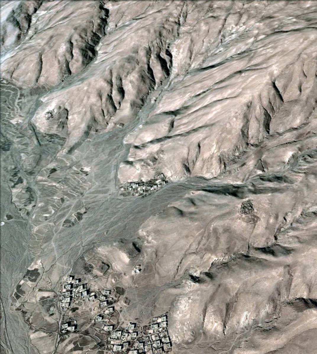
Fig. 2
Fig. 2: (Satellite Photo: Google|DigitalGlobe (12/2010))
Satellite Photo: Google|DigitalGlobe (12/2010); edited by G. Hazod 2013
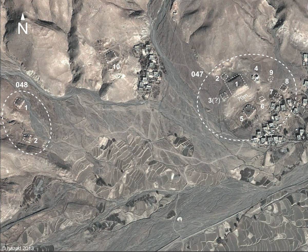
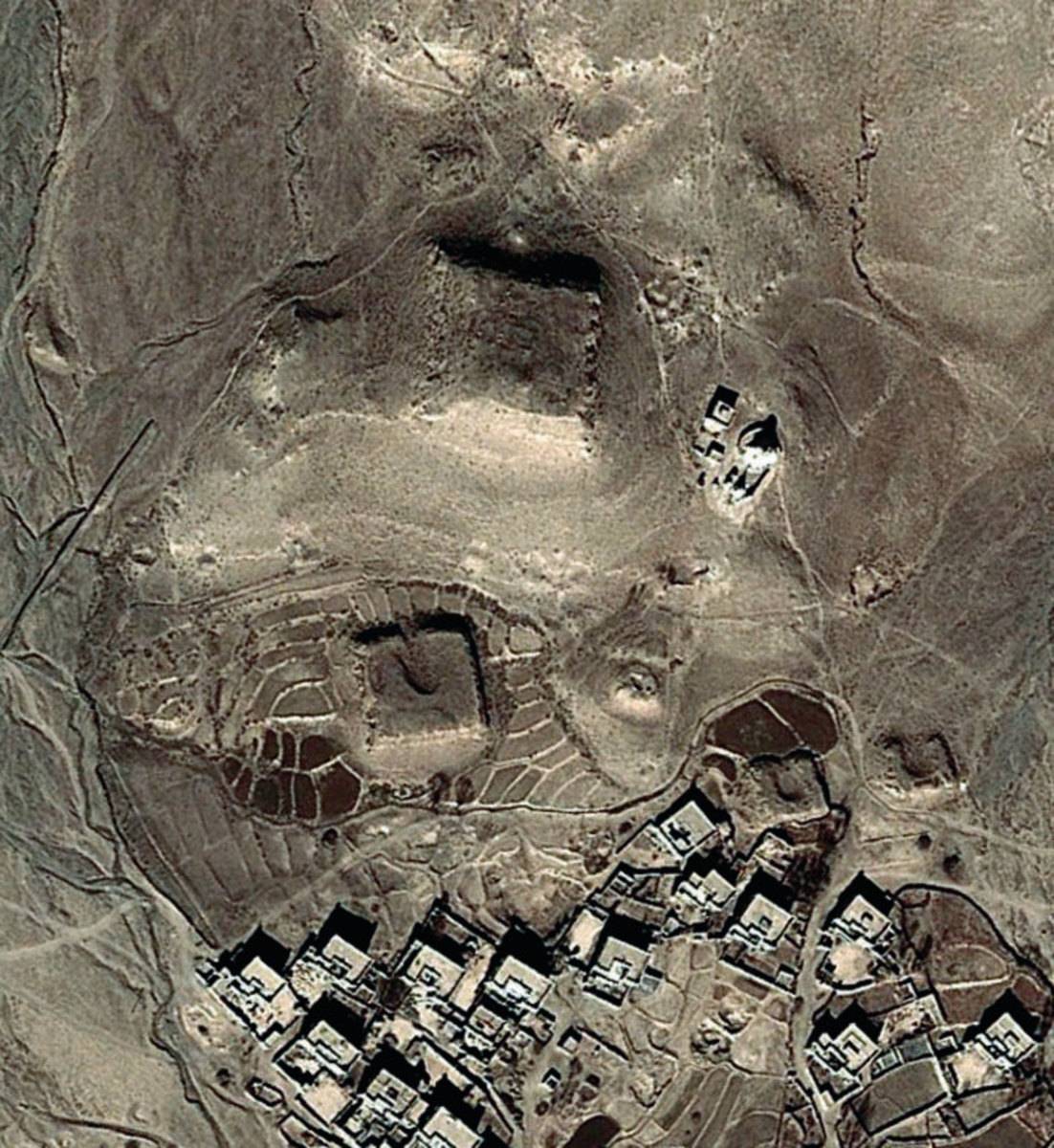
Fig. 3 The fields of Ser khung in Lower Grva (#0047, #0048).
Fig. 3: The fields of Ser khung in Lower Grva (#0047, #0048). (Satellite Photo: Google|DigitalGlobe (12/2010); edited by G. Hazod 2013)
Satellite Photo: Google|DigitalGlobe (01/2017); edited by G. Hazod 2018
Fig. 4 The field of #0043.
Fig. 4: The field of #0043. (Satellite Photo: Google|DigitalGlobe (01/2017); edited by G. Hazod 2018)
Satellite Photo: Google|DigitalGlobe (12/2010)
Fig. 5 M-1 of #00047.
Fig. 5: M-1 of #00047. (Satellite Photo: Google|DigitalGlobe (12/2010))
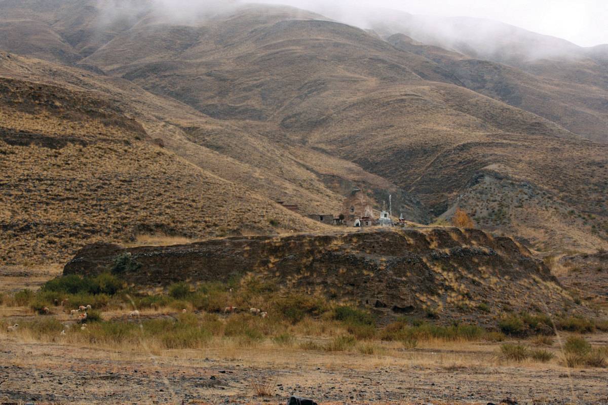
Photo: G. Hazod 2008
Fig. 6
Fig. 6: (Photo: G. Hazod 2008)

Photo: G. Hazod 2008
Fig. 7
Fig. 7: (Photo: G. Hazod 2008)
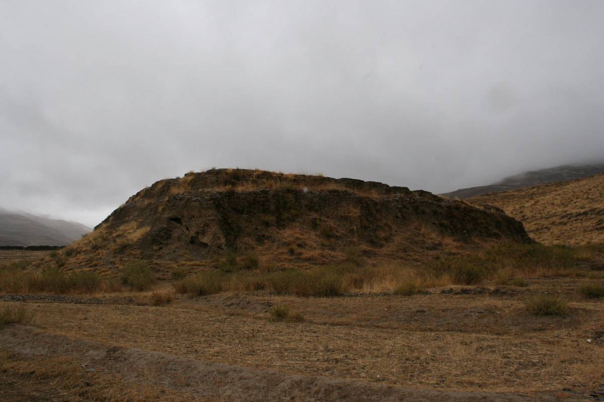
Photo: G. Hazod 2008
Fig. 8 M-8 (left) and M-7 of #0047.
Fig. 8: M-8 (left) and M-7 of #0047. (Photo: G. Hazod 2008)
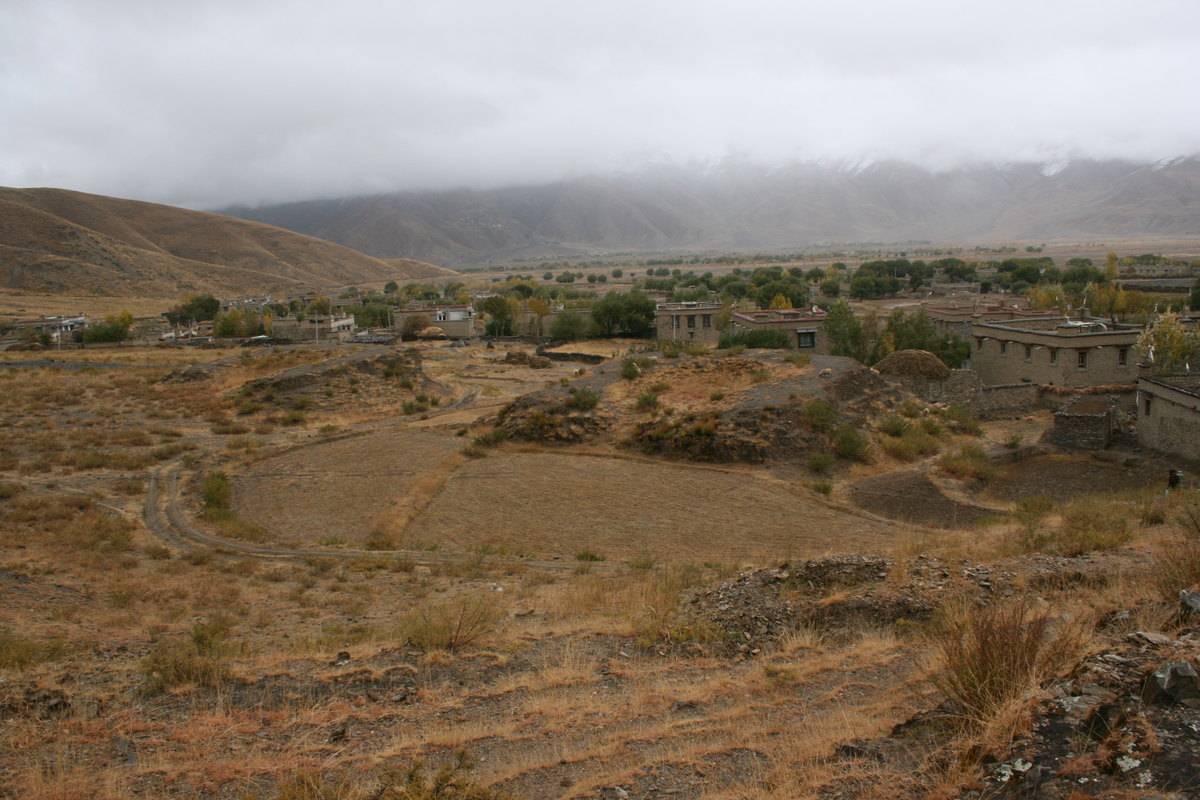
Photo: G. Hazod 2008
Fig. 9
Fig. 9: (Photo: G. Hazod 2008)
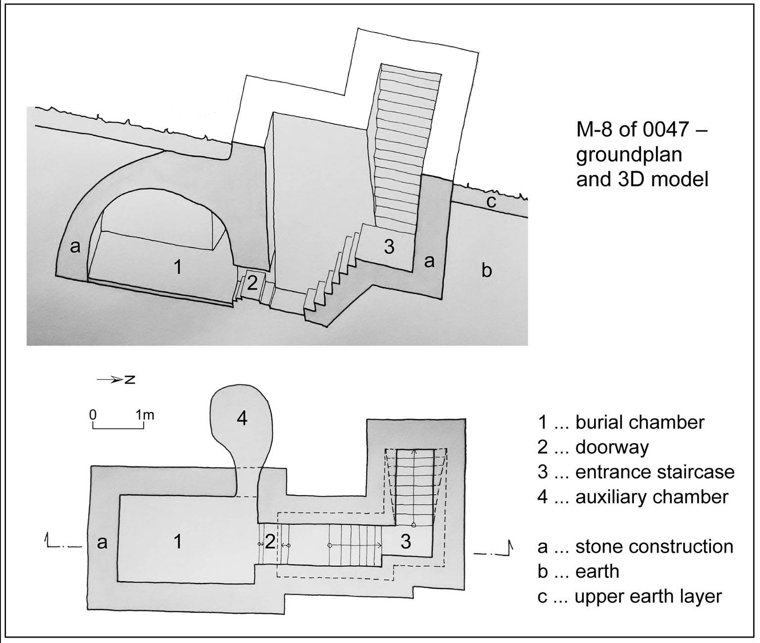
Drawing: H. Feiglstorfer 2018
Fig. 10 Reconstruction of the interior of M-8. (H. Feiglstorfer 2018, after Sonam Wangdu 1997; cf. also Chan 1994: 369; Chayet 1994: 75)
Fig. 10: Reconstruction of the interior of M-8. (H. Feiglstorfer 2018, after Sonam Wangdu 1997; cf. also Chan 1994: 369; Chayet 1994: 75) (Drawing: H. Feiglstorfer 2018)
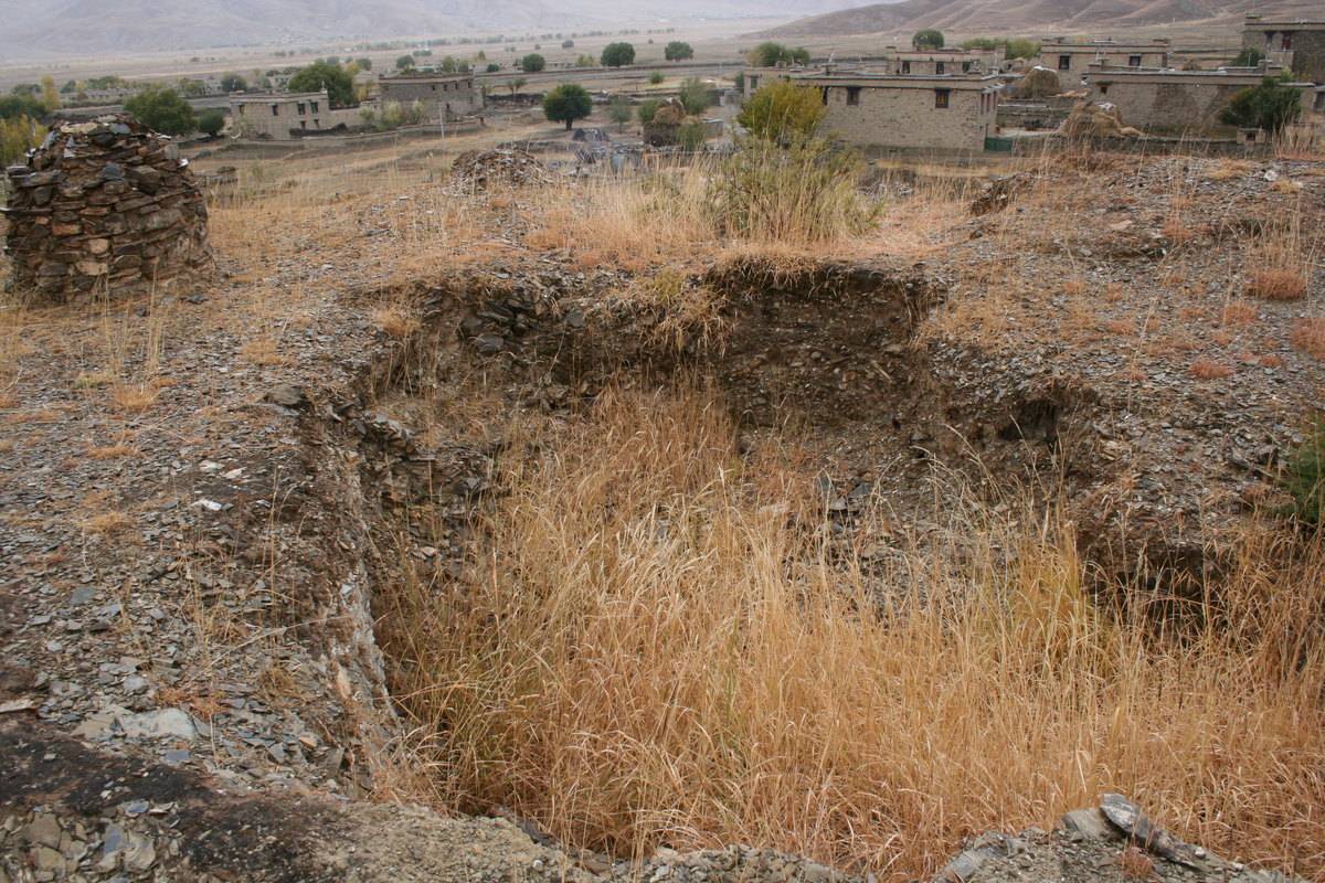
Photo: G. Hazod 2008
Fig. 11 The stupa-mound of #0047.
Fig. 11: The stupa-mound of #0047. (Photo: G. Hazod 2008)

Photo: G. Hazod 2008
Fig. 12 47
Fig. 12: 47 (Photo: G. Hazod 2008)
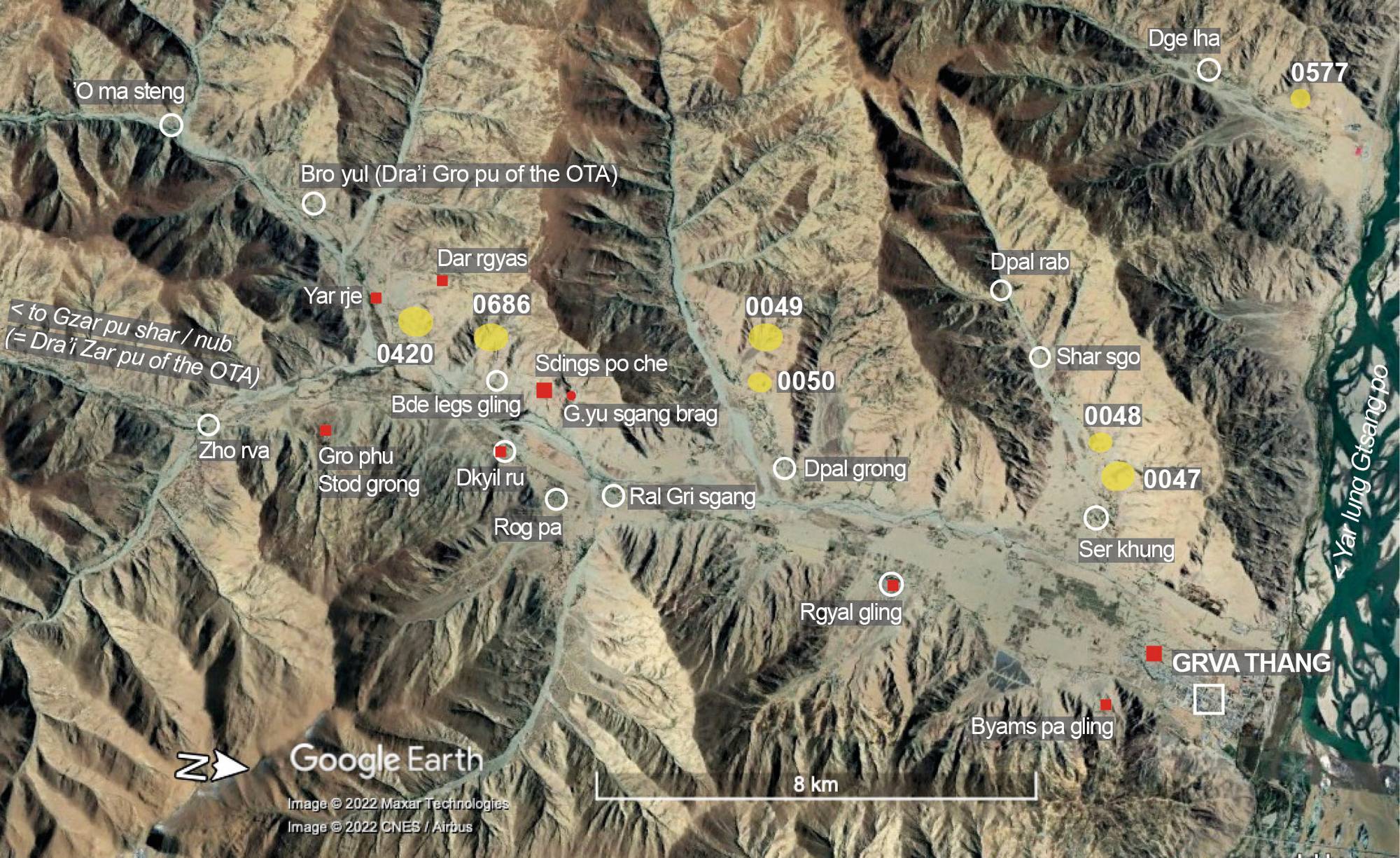
Satellite Photo: Google|Maxar Technologies 2022 (image data 10/2018); modifications and additional data by the author
Fig. 13 The tumulius sites (yellow symbol) of "inner Grva" (Grva nang). (The red symbols indicate religious sites).
Fig. 13: The tumulius sites (yellow symbol) of "inner Grva" (Grva nang). (The red symbols indicate religious sites). (Satellite Photo: Google|Maxar Technologies 2022 (image data 10/2018); modifications and additional data by the author)