#0529: Lam shod-1
- Town/Township
- Ri thang
- Coordinates
- 28°25'09", 92°13'09"
- Elevation
- 4080m
- Field Type
- FT-A
- Mound Type
- MT-C (25m)
- Status
- nv(sat)
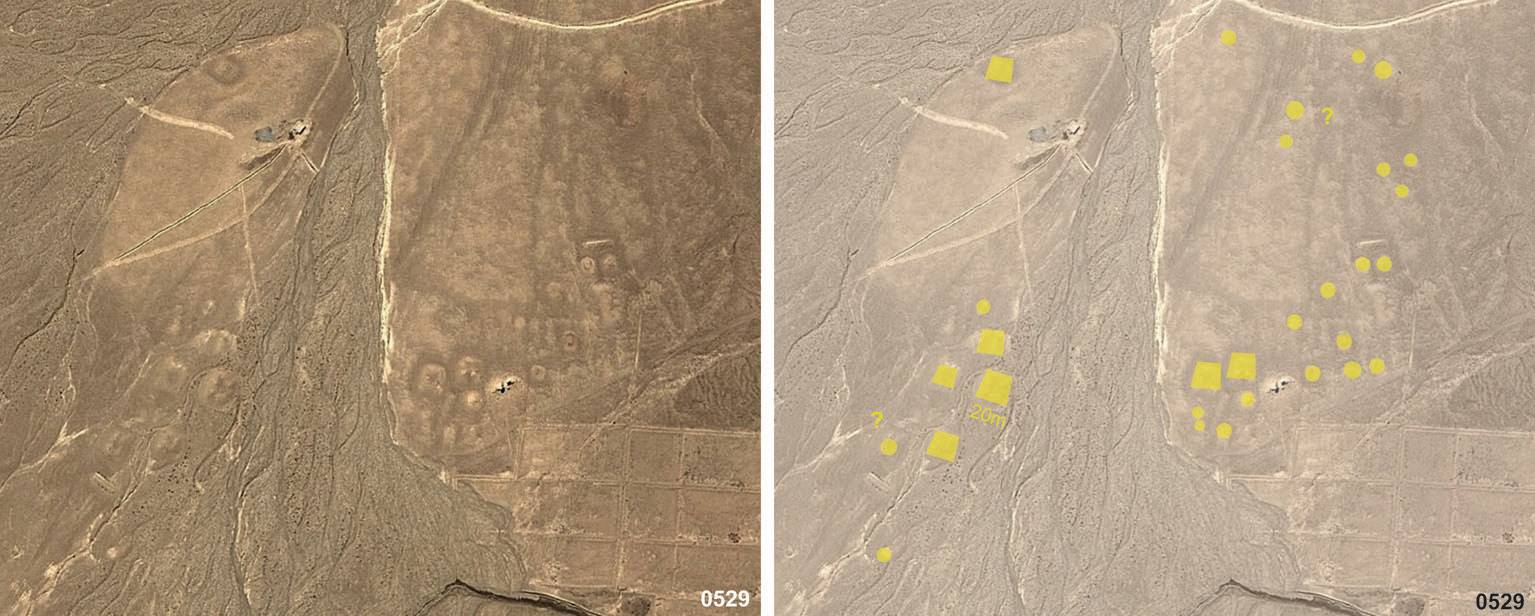
Satellite Photo: Google|DigitalGlobe (04/2011)
Fig. 1
Fig. 1: (Satellite Photo: Google|DigitalGlobe (04/2011))
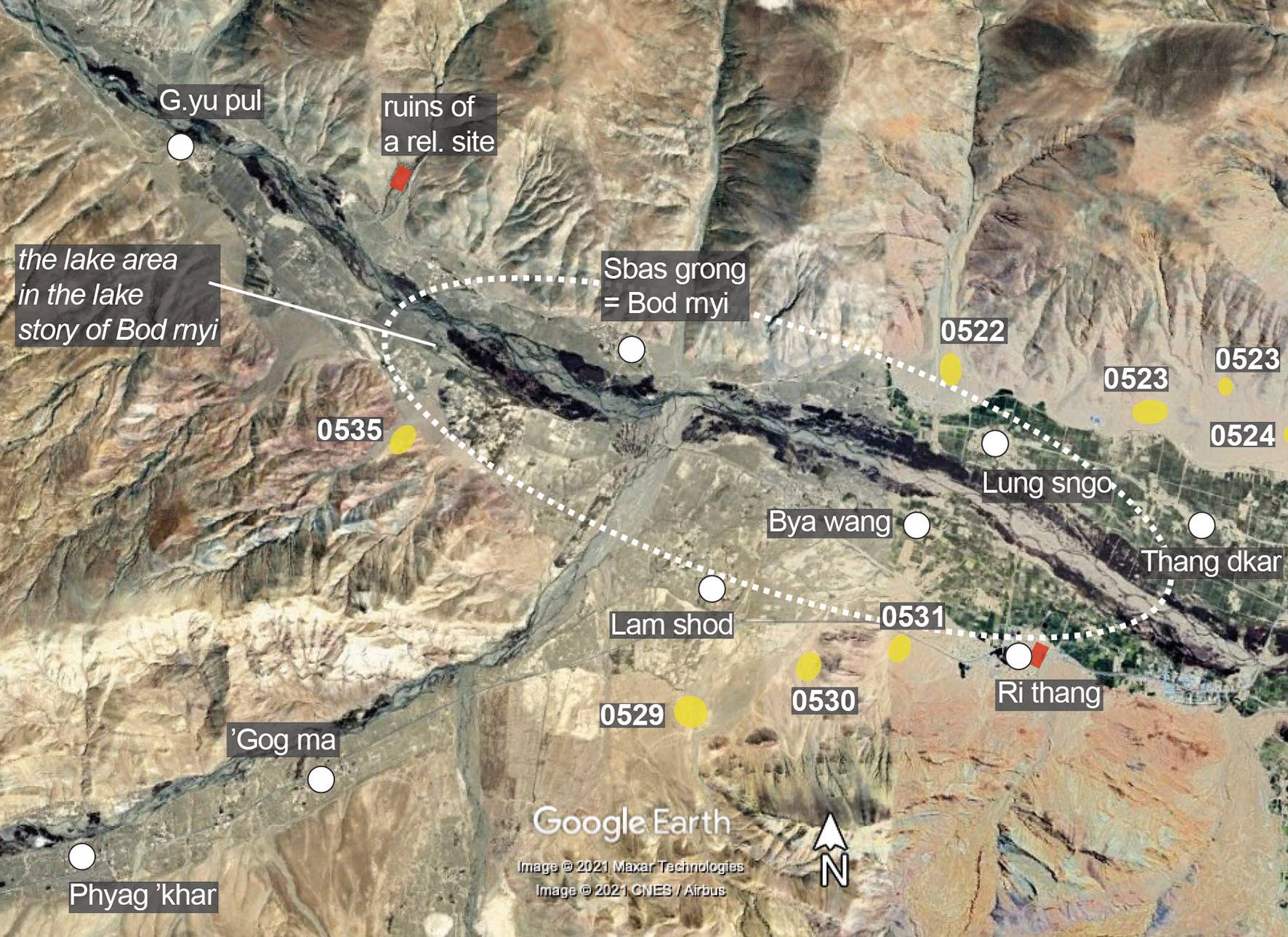
Map: G. Hazod 2021; Satellite Photo: Google|Maxar Technologies (12/2010); modifications and additional data by the author
Fig. 2 The area of Bod rnyi in Upper Gnyal, described as the origin place of the Rnyi ba (Snyi ba) lineage.
Fig. 2: The area of Bod rnyi in Upper Gnyal, described as the origin place of the Rnyi ba (Snyi ba) lineage. (Map: G. Hazod 2021; Satellite Photo: Google|Maxar Technologies (12/2010); modifications and additional data by the author)