#0063: Dbal sdings [Major Site]
- Town/Township
- Gram mda’
- Coordinates
- 28°57'01", 91°04'52"
- Elevation
- 4615m
- Field Type
- FT-A
- Mound Type
- MT-C (25-30m)
- Additional Classification
- major site
- Status
- nv(sat/ref)
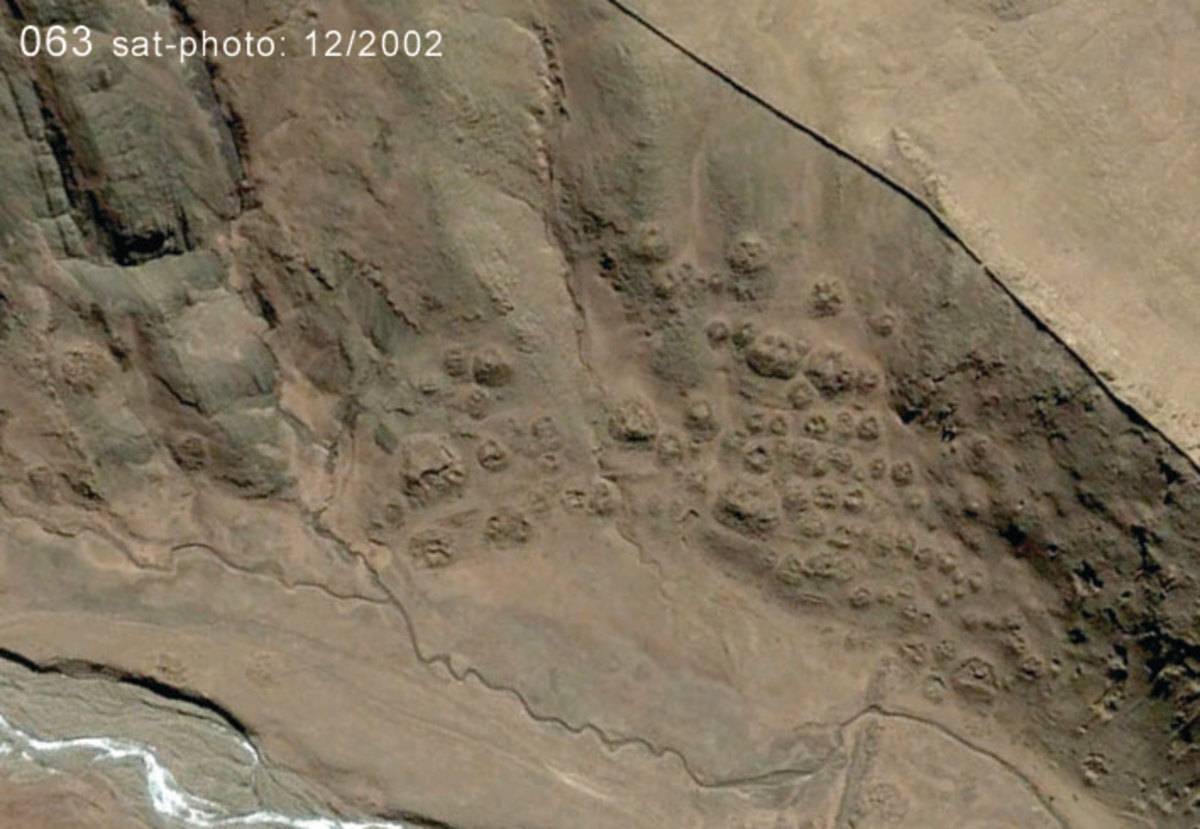
Satellite Photo: Google|DigitalGlobe (12/2002)
Fig. 1
Fig. 1: (Satellite Photo: Google|DigitalGlobe (12/2002))
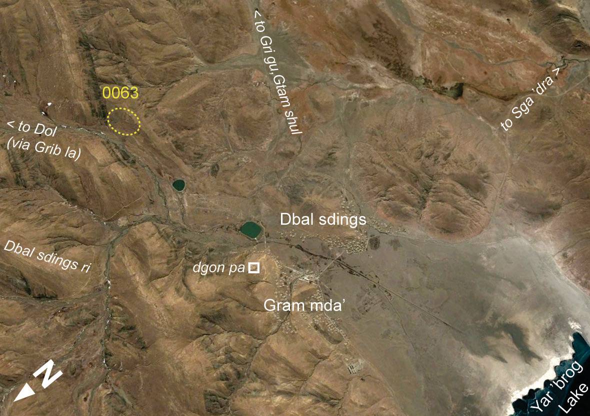
Satellite Photo: Google|DigitalGlobe; edited by G. Hazod 2016
Fig. 2
Fig. 2: (Satellite Photo: Google|DigitalGlobe; edited by G. Hazod 2016)
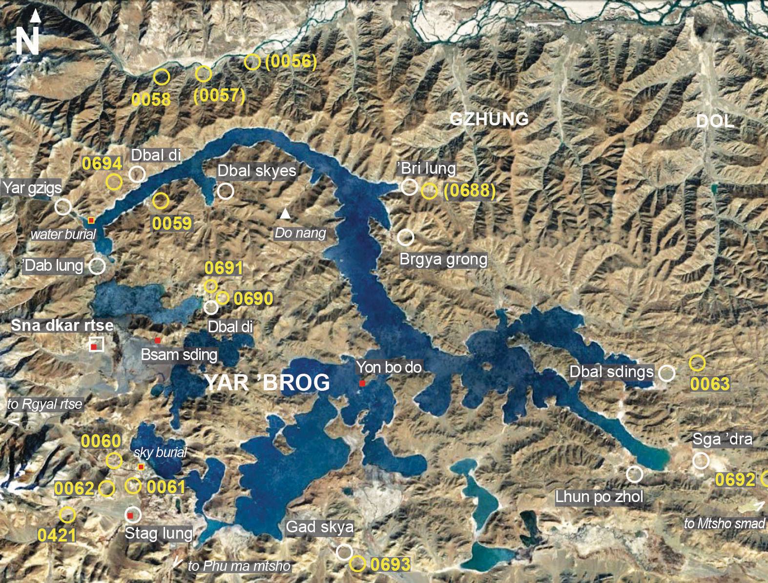
Satellite Photo: Google, Maxar Technologies 2022 (12/16/2013); edited by Hazod 2022
Fig. 3 The burial mound sites in the Yar 'brog region of Sna dkar rtse County
Fig. 3: The burial mound sites in the Yar 'brog region of Sna dkar rtse County (Satellite Photo: Google, Maxar Technologies 2022 (12/16/2013); edited by Hazod 2022)