#0686: Dar rgyas gling
- Town/Township
- Bro yul
- Coordinates
- 29°07'47", 91°17'26"
- Elevation
- 3870m
- Field Type
- FT-B
- Mound Type
- MT-C (10-15m)
- Status
- nv(sat)
Satellite Photo: Google|Maxar Technologies 2022 (image data 10/2018); modifications and additional data by the author
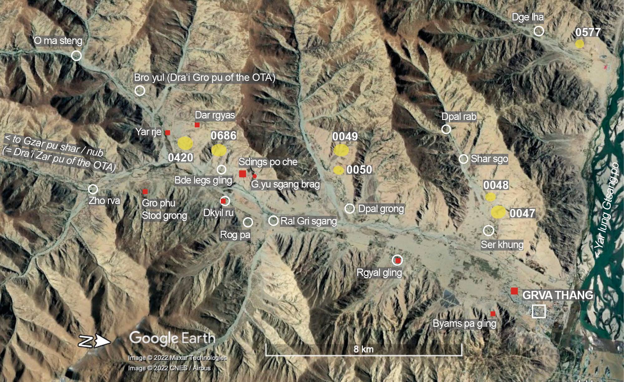
Fig. 1 The tumulius sites (yellow symbol) of "inner Grva" (Grva nang). (The red symbols indicate religious sites).
Fig. 1: The tumulius sites (yellow symbol) of "inner Grva" (Grva nang). (The red symbols indicate religious sites). (Satellite Photo: Google|Maxar Technologies 2022 (image data 10/2018); modifications and additional data by the author)