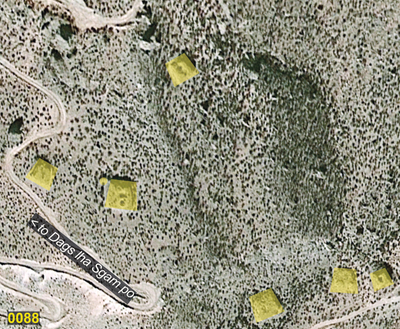
#0088: Jo stod
- Town/Township
- Gces
- Coordinates
- 29°06'30", 92°49'31"
- Elevation
- 3340m
- Field Type
- FT-B
- Mound Type
- MT-C (20m)
- Status
- nv(sat)
Satellite Photo: Google|Maxar Technologies 2020 (01/2010); edited by G. Hazod 2021
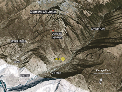
Fig. 1 The tumulus site of 0088 below the famous hermitage of Dags lha Sgam po in central Dvags po.

Fig. 1: The tumulus site of 0088 below the famous hermitage of Dags lha Sgam po in central Dvags po. (Satellite Photo: Google|Maxar Technologies 2020 (01/2010); edited by G. Hazod 2021)
Satellite Photo: Google|Maxar Technologies 2020 (01/2010); edited by G. Hazod 2021
Fig. 2

Fig. 2: (Satellite Photo: Google|Maxar Technologies 2020 (01/2010); edited by G. Hazod 2021)

Satellite Photo: Google|Maxar Technologies 2020 (02/2009); edited by G. Hazod 2021
Fig. 3 The area of ancient Dags yul in modern Rgya tshva County. Note: the burial mound sites with blue numbers refer to grave fields of neighbouring Snang County; the purple symbols indicate the site of the four Bya khyung ’Bab sa towers of Western Dvags po.
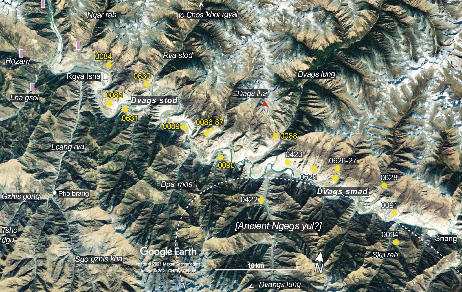
Fig. 3: The area of ancient Dags yul in modern Rgya tshva County. Note: the burial mound sites with blue numbers refer to grave fields of neighbouring Snang County; the purple symbols indicate the site of the four Bya khyung ’Bab sa towers of Western Dvags po. (Satellite Photo: Google|Maxar Technologies 2020 (02/2009); edited by G. Hazod 2021)