#0093: Sleb-W [Major Site]
- Town/Township
- Skyems stong
- Coordinates
- 28°59'26", 93°20'23"
- Elevation
- 3550m
- Field Type
- FT-B
- Mound Type
- MT-C, MT-D (30m)
- Additional Classification
- major site
- Status
- v(2005)

Photos: 1982 (copy from TASS); Satellite Photo: Google|DigitalGlobe (04/2012); edited by G. Hazod 2013
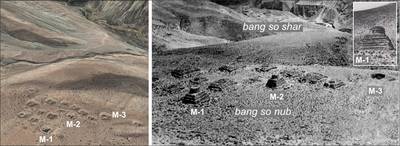
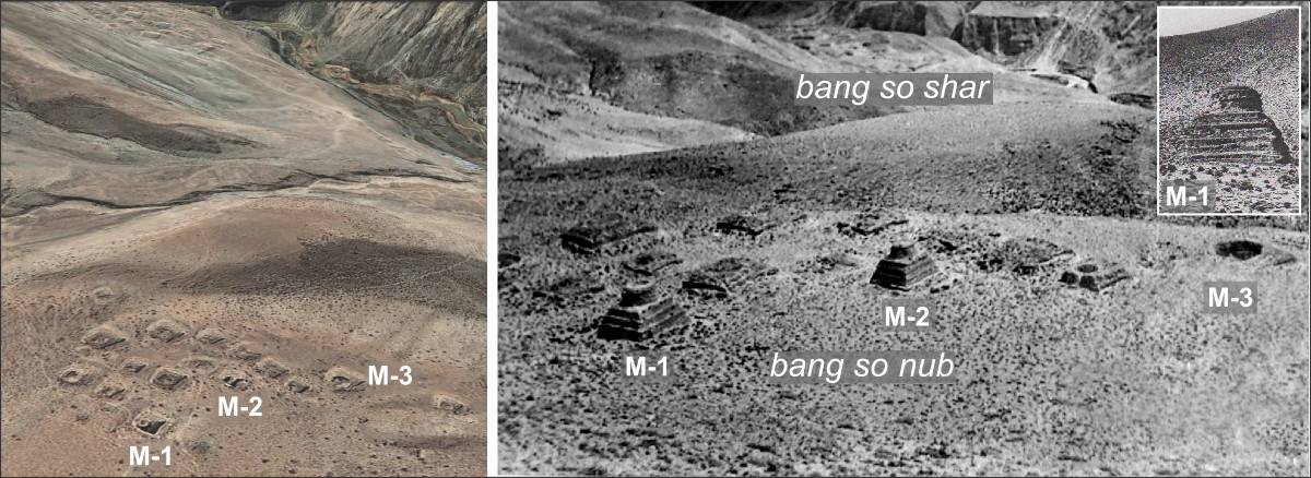
Fig. 1 The Bang so shar field in Skyem stong (#0093). Its particular feature is the stupa-like structure of several of the burial mounds, which most likely are to be dated to the late 8th or 9th century CE (cf. also #0047).

Fig. 1: The Bang so shar field in Skyem stong (#0093). Its particular feature is the stupa-like structure of several of the burial mounds, which most likely are to be dated to the late 8th or 9th century CE (cf. also #0047). (Photos: 1982 (copy from TASS); Satellite Photo: Google|DigitalGlobe (04/2012); edited by G. Hazod 2013)