#0096: Klu sdings
- Town/Township
- Stag rtse
- Coordinates
- 29°27'24", 94°28'47"
- Elevation
- 2995m
- Field Type
- FT-C
- Mound Type
- MT-A (25-30m(?))
- Status
- nv(sat)
Satellite Photo: Google|DigitalGlobe (11/2007); edited by G. Hazod 2013
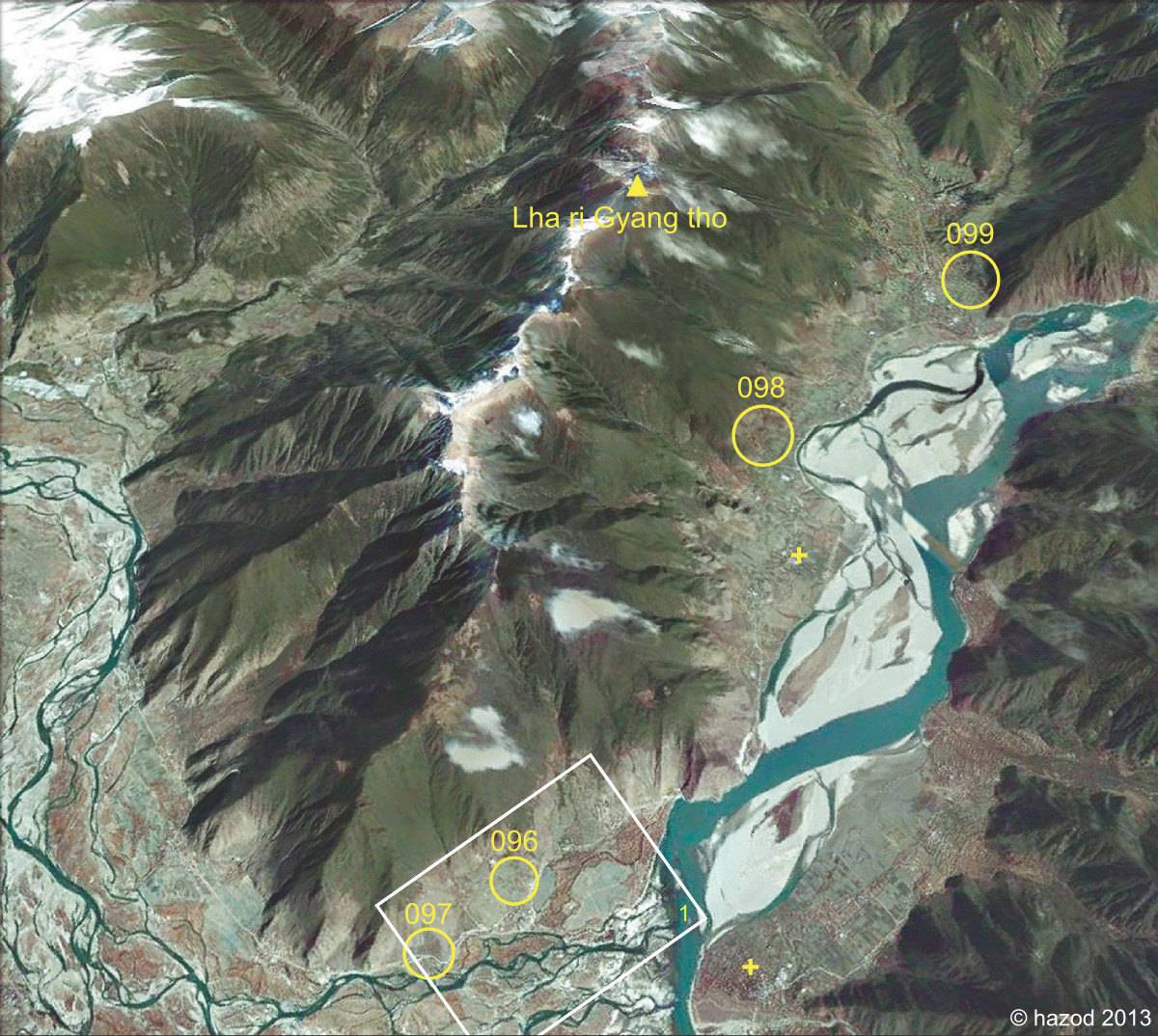
Fig. 1 The area at the foot of Mt Lha ri Gyang tho in Central Kong po (see for details Ramble 1997: 142). (Except of #0097, the presumed fields indicated on the map stilll need to be examined in situ. The cross symbol refers to the site of the 8th-century "Kong po inscription" in G.yung drung 'dzin and of its copy in Gtam snyan.)
Fig. 1: The area at the foot of Mt Lha ri Gyang tho in Central Kong po (see for details Ramble 1997: 142). (Except of #0097, the presumed fields indicated on the map stilll need to be examined in situ. The cross symbol refers to the site of the 8th-century "Kong po inscription" in G.yung drung 'dzin and of its copy in Gtam snyan.) (Satellite Photo: Google|DigitalGlobe (11/2007); edited by G. Hazod 2013)
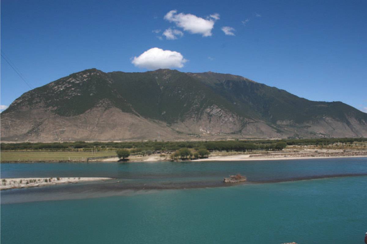
Photo: G. Hazod 2009
Fig. 2 Mt Lha ri Gyang mtho (Kong po Bon ri).
Fig. 2: Mt Lha ri Gyang mtho (Kong po Bon ri). (Photo: G. Hazod 2009)
Satellite Photo: Google|DigitalGlobe (11/2007); edited by G. Hazod 2013
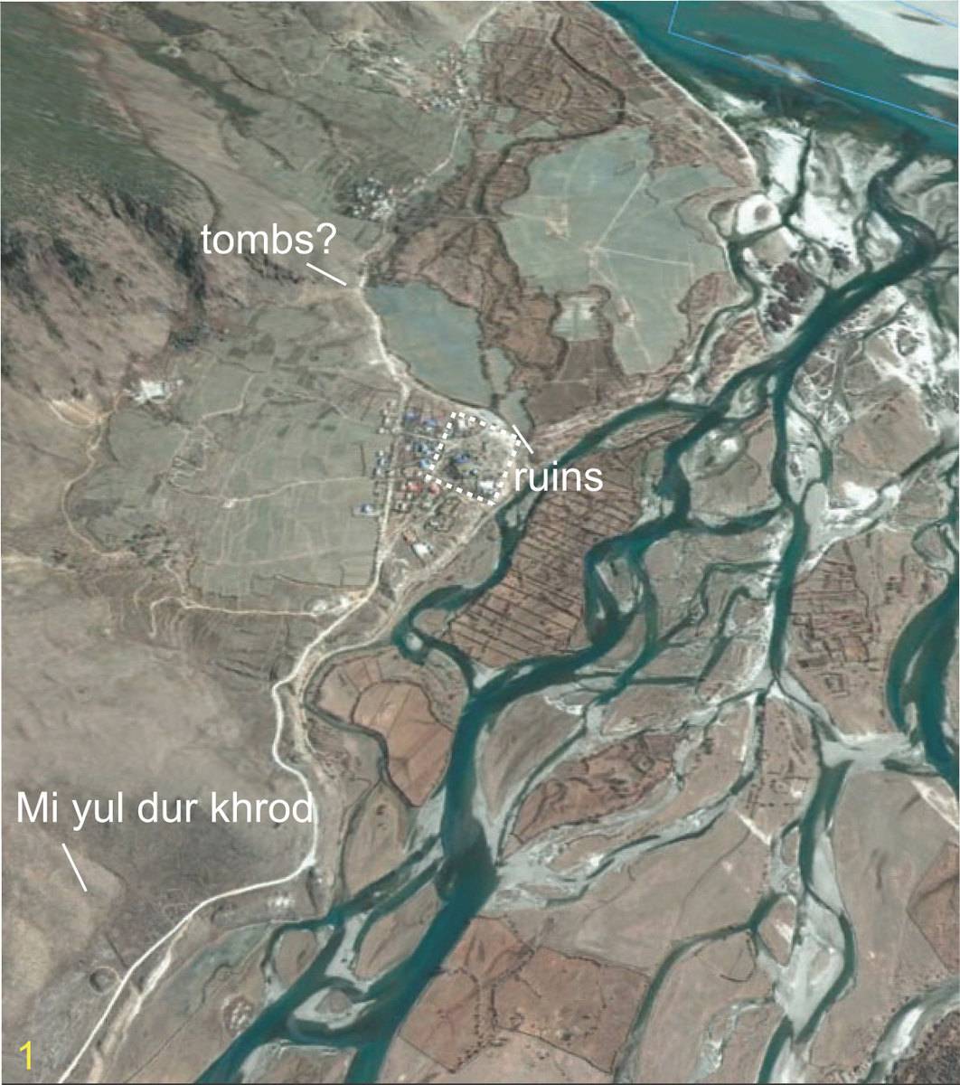
Fig. 3 Mi yul Skyi sdings, Bre sna and Klu sdings at the confluence of Nyang po and Gtsang po.
Fig. 3: Mi yul Skyi sdings, Bre sna and Klu sdings at the confluence of Nyang po and Gtsang po. (Satellite Photo: Google|DigitalGlobe (11/2007); edited by G. Hazod 2013)